Area Overview for SW9 0SP
Photos of SW9 0SP
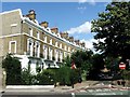
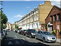
100 photos from this area
Area Information
Key information about the SW9 0SP including its size, population, and administrative classification.
- Area Type
- Postcode
- Area Size
- 6220 m²
- Population
- 2092
- Population Density
- 15577 people/km²
House Prices in SW9 0SP
44
Properties
£652,718
Average Sold Price
£229,950
Lowest Price
£1,200,000
Highest Price
Showing 44 properties
| Address | Type | Beds | Baths | Last Sale Price | Last Sale Date | |
|---|---|---|---|---|---|---|
| 5 St Martins Road, London, SW9 0SP | Terraced | 5 | 2 | £711,167 | Jan 2025 | |
| 39 St Martins Road, London, SW9 0SP | Terraced | 3 | 2 | £1,180,000 | Dec 2023 | |
| 37 St Martins Road, London, SW9 0SP | house | 4 | 2 | £1,200,000 | Dec 2022 | |
| 21 St Martins Road, London, SW9 0SP | house | - | - | £1,120,000 | Mar 2021 | |
| 23 St Martins Road, London, SW9 0SP | Terraced | 4 | 2 | £765,000 | Jul 2012 | |
| 45 St Martins Road, London, SW9 0SP | Detached | 3 | 2 | £530,000 | Feb 2007 | |
| 41 St Martins Road, London, SW9 0SP | Terraced | - | - | £522,500 | Sep 2006 | |
| 33A St Martins Road, London, SW9 0SP | Flat | - | - | £229,950 | Jun 2006 | |
| 27 St Martins Road, London, SW9 0SP | Terraced | - | - | £565,000 | Jan 2006 | |
| 43 St Martins Road, London, SW9 0SP | house | - | - | £421,000 | Aug 2003 |
Page 1 of 5
Energy Efficiency in SW9 0SP
Amenities
Schools
| Rank | School | Type | Entry gender | Ages |
|---|
Explore more schools in this area
Go to Schools tabDemographics
Household Size
Family (3-5 people)
most common
Accommodation Type
Flats
most common
Tenure
35
majority
Ethnic Group
White
most common
Religion
N/A
most common
Household Composition
N/A
most common
Age
47
median
Adults (30-64 years)
most common
Household Deprivation
N/A
with no deprivation
NS-SEC
45
in Lower managerial occupations
Explore more demographic insights in this area
Go to Demographics tabPlanning
Planning Constraints
- Flood RiskPremium
- Ramsar Wetland SitesPremium
- Area of Outstanding Natural BeautyPremium
- Protected Nature ReservePremium
- Protected WoodlandPremium