Area Overview for SW7 1HY
Photos of SW7 1HY


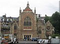
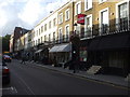
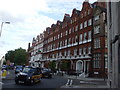
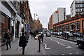
100 photos from this area
Area Information
Key information about the SW7 1HY including its size, population, and administrative classification.
- Area Type
- Postcode
- Area Size
- 1507 m²
- Population
- 2568
- Population Density
- 961 people/km²
House Prices in SW7 1HY
17
Properties
£1,908,545
Average Sold Price
£775,000
Lowest Price
£2,999,000
Highest Price
Showing 17 properties
| Address | Type | Beds | Baths | Last Sale Price | Last Sale Date | |
|---|---|---|---|---|---|---|
| 13 Ennismore Gardens Mews, London, SW7 1HY | Terraced | 2 | 3 | £2,985,000 | Jan 2025 | |
| 18 Ennismore Gardens Mews, London, SW7 1HY | Terraced | 3 | 2 | £1,600,000 | Jul 2024 | |
| 17 Ennismore Gardens Mews, London, SW7 1HY | Terraced | 3 | 2 | £2,999,000 | Nov 2022 | |
| 25 Ennismore Gardens Mews, London, SW7 1HY | house | 2 | - | £2,800,000 | Aug 2021 | |
| 23 Ennismore Gardens Mews, London, SW7 1HY | Terraced | 3 | - | £2,200,000 | Apr 2019 | |
| 24 Ennismore Gardens Mews, London, SW7 1HY | Terraced | 1 | 1 | £1,950,000 | Jan 2012 | |
| 12 Ennismore Gardens Mews, London, SW7 1HY | house | 2 | - | £1,800,000 | Apr 2010 | |
| 22 Ennismore Gardens Mews, London, SW7 1HY | Terraced | 3 | 2 | £1,500,000 | Aug 2009 | |
| 20 Ennismore Gardens Mews, London, SW7 1HY | Terraced | 3 | 2 | £1,050,000 | Dec 2005 | |
| 21 Ennismore Gardens Mews, London, SW7 1HY | house | 2 | - | £1,335,000 | Jul 2005 |
Page 1 of 2
Energy Efficiency in SW7 1HY
Amenities
Schools
| Rank | School | Type | Entry gender | Ages |
|---|
Explore more schools in this area
Go to Schools tabDemographics
Household Size
One person
most common
Accommodation Type
Flats
most common
Tenure
46
majority
Ethnic Group
White
most common
Religion
N/A
most common
Household Composition
N/A
most common
Age
22
median
Young Adults (15-29 years)
most common
Household Deprivation
N/A
with no deprivation
NS-SEC
34
in Lower managerial occupations
Explore more demographic insights in this area
Go to Demographics tabPlanning
Planning Constraints
- Flood RiskPremium
- Ramsar Wetland SitesPremium
- Area of Outstanding Natural BeautyPremium
- Protected Nature ReservePremium
- Protected WoodlandPremium