Area Overview for SW6 7HD
Photos of SW6 7HD
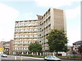
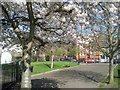
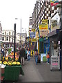
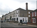
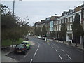

100 photos from this area
Area Information
Key information about the SW6 7HD including its size, population, and administrative classification.
- Area Type
- Postcode
- Area Size
- 3040 m²
- Population
- 1451
- Population Density
- 18047 people/km²
House Prices in SW6 7HD
32
Properties
£816,488
Average Sold Price
£489,950
Lowest Price
£1,185,000
Highest Price
Showing 32 properties
| Address | Type | Beds | Baths | Last Sale Price | Last Sale Date | |
|---|---|---|---|---|---|---|
| 162A Estcourt Road, London, SW6 7HD | Terraced | 4 | 2 | £1,185,000 | Jul 2024 | |
| 168 Estcourt Road, London, SW6 7HD | Terraced | 4 | - | £946,000 | Jan 2014 | |
| 166 Estcourt Road, London, SW6 7HD | house | 3 | 2 | £645,000 | Apr 2012 | |
| 164 Estcourt Road, London, SW6 7HD | Terraced | 4 | 2 | £489,950 | Apr 2006 | |
| Flat Ground Floor, 162 Estcourt Road, London, SW6 7HD | Flat | - | - | - | - | |
| Flat Ground Floor, 172 Estcourt Road, London, SW6 7HD | Flat | - | - | - | - | |
| Flat First Floor, 162 Estcourt Road, London, SW6 7HD | Flat | - | - | - | - | |
| Flat B First Floor, 172 Estcourt Road, London, SW6 7HD | Flat | - | - | - | - | |
| Flat D, 174 Estcourt Road, London, SW6 7HD | Flat | - | - | - | - | |
| Flat D, 176 Estcourt Road, London, SW6 7HD | Flat | - | - | - | - |
Page 1 of 4
Energy Efficiency in SW6 7HD
Amenities
Schools
| Rank | School | Type | Entry gender | Ages |
|---|
Explore more schools in this area
Go to Schools tabDemographics
Household Size
One person
most common
Accommodation Type
Flats
most common
Tenure
34
majority
Ethnic Group
White
most common
Religion
N/A
most common
Household Composition
N/A
most common
Age
47
median
Adults (30-64 years)
most common
Household Deprivation
N/A
with no deprivation
NS-SEC
41
in Lower managerial occupations
Explore more demographic insights in this area
Go to Demographics tabPlanning
Planning Constraints
- Flood RiskPremium
- Ramsar Wetland SitesPremium
- Area of Outstanding Natural BeautyPremium
- Protected Nature ReservePremium
- Protected WoodlandPremium