Area Overview for SW6 6SS
Photos of SW6 6SS
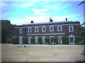
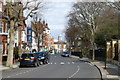
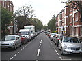
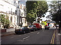
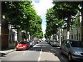
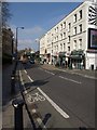
100 photos from this area
Area Information
Key information about the SW6 6SS including its size, population, and administrative classification.
- Area Type
- Postcode
- Area Size
- 3055 m²
- Population
- 1617
- Population Density
- 11460 people/km²
House Prices in SW6 6SS
31
Properties
£1,076,775
Average Sold Price
£365,000
Lowest Price
£1,895,200
Highest Price
Showing 31 properties
| Address | Type | Beds | Baths | Last Sale Price | Last Sale Date | |
|---|---|---|---|---|---|---|
| 78 Kingwood Road, London, SW6 6SS | Terraced | 4 | 2 | £1,382,000 | Sep 2023 | |
| 98 Kingwood Road, London, SW6 6SS | Terraced | 4 | 3 | £1,225,000 | Jan 2022 | |
| 86 Kingwood Road, London, SW6 6SS | Terraced | 3 | 3 | £1,895,200 | May 2016 | |
| 88 Kingwood Road, London, SW6 6SS | Terraced | 2 | 1 | £1,310,000 | May 2014 | |
| 94 Kingwood Road, London, SW6 6SS | house | 3 | - | £1,295,000 | Oct 2013 | |
| 76 Kingwood Road, London, SW6 6SS | Terraced | 4 | 2 | £610,000 | May 2009 | |
| 84 Kingwood Road, London, SW6 6SS | Terraced | 4 | 2 | £532,000 | Oct 2003 | |
| 92 Kingwood Road, London, SW6 6SS | Terraced | 4 | 2 | £365,000 | Dec 2000 | |
| Top Floor, 80 Kingwood Road, London, SW6 6SS | Maisonette | 4 | 3 | - | - | |
| Flat A, 100 Kingwood Road, London, SW6 6SS | Maisonette | - | - | - | - |
Page 1 of 4
Energy Efficiency in SW6 6SS
Amenities
Schools
| Rank | School | Type | Entry gender | Ages |
|---|
Explore more schools in this area
Go to Schools tabDemographics
Household Size
Two person
most common
Accommodation Type
Flats
most common
Tenure
51
majority
Ethnic Group
White
most common
Religion
N/A
most common
Household Composition
N/A
most common
Age
47
median
Adults (30-64 years)
most common
Household Deprivation
N/A
with no deprivation
NS-SEC
60
in Lower managerial occupations
Explore more demographic insights in this area
Go to Demographics tabPlanning
Planning Constraints
- Flood RiskPremium
- Ramsar Wetland SitesPremium
- Area of Outstanding Natural BeautyPremium
- Protected Nature ReservePremium
- Protected WoodlandPremium