Area Overview for SW6 5AR
Photos of SW6 5AR
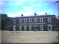
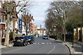
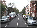
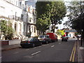
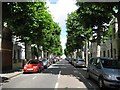
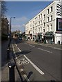
100 photos from this area
Area Information
Key information about the SW6 5AR including its size, population, and administrative classification.
- Area Type
- Postcode
- Area Size
- 2228 m²
- Population
- 1473
- Population Density
- 18321 people/km²
House Prices in SW6 5AR
19
Properties
£1,452,469
Average Sold Price
£2,750
Lowest Price
£2,550,000
Highest Price
Showing 19 properties
| Address | Type | Beds | Baths | Last Sale Price | Last Sale Date | |
|---|---|---|---|---|---|---|
| 57 Rostrevor Road, London, SW6 5AR | house | - | - | £1,702,000 | Jun 2022 | |
| 73 Rostrevor Road, London, SW6 5AR | house | 3 | 1 | £1,905,000 | Jun 2021 | |
| 51 Rostrevor Road, London, SW6 5AR | house | - | - | £1,435,000 | Mar 2021 | |
| 69 Rostrevor Road, London, SW6 5AR | Terraced | 4 | 3 | £1,660,000 | Mar 2021 | |
| 59 Rostrevor Road, London, SW6 5AR | Terraced | 4 | 5 | £2,550,000 | Dec 2013 | |
| 61 Rostrevor Road, London, SW6 5AR | Terraced | 4 | 2 | £1,495,000 | Nov 2011 | |
| 55 Rostrevor Road, London, SW6 5AR | Terraced | - | - | £870,000 | May 2005 | |
| 53 Rostrevor Road, London, SW6 5AR | Flat | 2 | 1 | £2,750 | Nov 1995 | |
| Flat B First Floor, 71 Rostrevor Road, London, SW6 5AR | Maisonette | 3 | - | - | - | |
| Flat A Ground Floor, 67 Rostrevor Road, London, SW6 5AR | Flat | - | - | - | - |
Page 1 of 2
Energy Efficiency in SW6 5AR
Amenities
Schools
| Rank | School | Type | Entry gender | Ages |
|---|
Explore more schools in this area
Go to Schools tabDemographics
Household Size
One person
most common
Accommodation Type
Flats
most common
Tenure
45
majority
Ethnic Group
White
most common
Religion
N/A
most common
Household Composition
N/A
most common
Age
47
median
Adults (30-64 years)
most common
Household Deprivation
N/A
with no deprivation
NS-SEC
63
in Lower managerial occupations
Explore more demographic insights in this area
Go to Demographics tabPlanning
Planning Constraints
- Flood RiskPremium
- Ramsar Wetland SitesPremium
- Area of Outstanding Natural BeautyPremium
- Protected Nature ReservePremium
- Protected WoodlandPremium