Area Overview for SW6 4HS
Photos of SW6 4HS
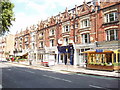
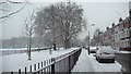
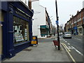
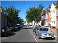
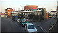
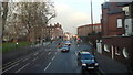
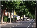
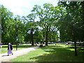
100 photos from this area
Area Information
Key information about the SW6 4HS including its size, population, and administrative classification.
- Area Type
- Postcode
- Area Size
- 7791 m²
- Population
- 1486
- Population Density
- 13785 people/km²
House Prices in SW6 4HS
53
Properties
£1,060,861
Average Sold Price
£110,000
Lowest Price
£2,435,000
Highest Price
Showing 53 properties
| Address | Type | Beds | Baths | Last Sale Price | Last Sale Date | |
|---|---|---|---|---|---|---|
| 44A Parsons Green Lane, London, SW6 4HS | Terraced | 2 | 2 | £600,000 | Aug 2024 | |
| 18 Parsons Green Lane, London, SW6 4HS | Terraced | 5 | 2 | £2,435,000 | Aug 2024 | |
| 44 Parsons Green Lane, London, SW6 4HS | Terraced | 2 | 1 | £785,000 | Sep 2022 | |
| 10 Parsons Green Lane, London, SW6 4HS | Terraced | 4 | 3 | £1,675,000 | Nov 2021 | |
| 20 Parsons Green Lane, London, SW6 4HS | house | - | - | £2,180,000 | Sep 2021 | |
| 8 Parsons Green Lane, London, SW6 4HS | house | - | - | £1,900,000 | Aug 2021 | |
| 12 Parsons Green Lane, London, SW6 4HS | Terraced | 5 | 3 | £1,725,000 | Jan 2019 | |
| 46B Parsons Green Lane, London, SW6 4HS | house | 4 | - | £1,175,000 | Mar 2013 | |
| 42 Parsons Green Lane, London, SW6 4HS | Terraced | 2 | 1 | £600,000 | Dec 2012 | |
| 30A Parsons Green Lane, London, SW6 4HS | Maisonette | - | - | £675,000 | Apr 2008 |
Page 1 of 6
Energy Efficiency in SW6 4HS
Amenities
Schools
| Rank | School | Type | Entry gender | Ages |
|---|
Explore more schools in this area
Go to Schools tabDemographics
Household Size
Family (3-5 people)
most common
Accommodation Type
Houses
most common
Tenure
52
majority
Ethnic Group
White
most common
Religion
N/A
most common
Household Composition
N/A
most common
Age
47
median
Adults (30-64 years)
most common
Household Deprivation
N/A
with no deprivation
NS-SEC
64
in Lower managerial occupations
Explore more demographic insights in this area
Go to Demographics tabPlanning
Planning Constraints
- Flood RiskPremium
- Ramsar Wetland SitesPremium
- Area of Outstanding Natural BeautyPremium
- Protected Nature ReservePremium
- Protected WoodlandPremium