Area Overview for SW6 3ND
Photos of SW6 3ND
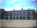

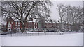
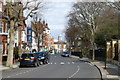
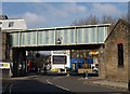
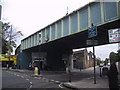
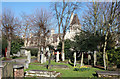
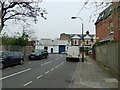
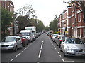
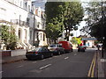
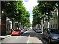
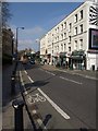
100 photos from this area
Area Information
Key information about the SW6 3ND including its size, population, and administrative classification.
- Area Type
- Postcode
- Area Size
- 3495 m²
- Population
- 1356
- Population Density
- 14967 people/km²
House Prices in SW6 3ND
26
Properties
£793,068
Average Sold Price
£195,000
Lowest Price
£1,390,750
Highest Price
Showing 26 properties
| Address | Type | Beds | Baths | Last Sale Price | Last Sale Date | |
|---|---|---|---|---|---|---|
| 34 Ewald Road, London, SW6 3ND | Terraced | 4 | 2 | £1,325,000 | Sep 2024 | |
| 26 Ewald Road, London, SW6 3ND | Terraced | 3 | 3 | £1,390,750 | Jul 2024 | |
| 12 Ewald Road, London, SW6 3ND | Terraced | 4 | 2 | £1,065,000 | Jul 2024 | |
| 1A, Victoria Villas, Ewald Road, London, SW6 3ND | Terraced | 2 | 1 | £915,000 | Apr 2024 | |
| 2, Victoria Villas, Ewald Road, London, SW6 3ND | Terraced | 4 | 2 | £1,200,000 | Jun 2021 | |
| 14 Ewald Road, London, SW6 3ND | Flat | 3 | 2 | £1,290,000 | Feb 2021 | |
| 16 Ewald Road, London, SW6 3ND | Terraced | 3 | 3 | £972,500 | Sep 2013 | |
| 36 Ewald Road, London, SW6 3ND | Terraced | 4 | 3 | £755,000 | Jun 2011 | |
| 3, Victoria Villas, Ewald Road, London, SW6 3ND | Terraced | 3 | 3 | £660,000 | Dec 2010 | |
| 42 Ewald Road, London, SW6 3ND | Terraced | 4 | 2 | £239,700 | Nov 2004 |
Page 1 of 3
Energy Efficiency in SW6 3ND
Amenities
Schools
| Rank | School | Type | Entry gender | Ages |
|---|
Explore more schools in this area
Go to Schools tabDemographics
Household Size
Two person
most common
Accommodation Type
Houses
most common
Tenure
57
majority
Ethnic Group
White
most common
Religion
N/A
most common
Household Composition
N/A
most common
Age
47
median
Adults (30-64 years)
most common
Household Deprivation
N/A
with no deprivation
NS-SEC
63
in Lower managerial occupations
Explore more demographic insights in this area
Go to Demographics tabPlanning
Planning Constraints
- Flood RiskPremium
- Ramsar Wetland SitesPremium
- Area of Outstanding Natural BeautyPremium
- Protected Nature ReservePremium
- Protected WoodlandPremium