Area Overview for SW6 3BU
Photos of SW6 3BU
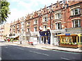
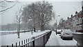
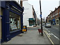
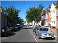
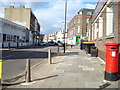
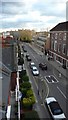
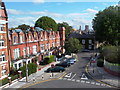
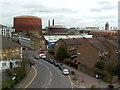
100 photos from this area
Area Information
Key information about the SW6 3BU including its size, population, and administrative classification.
- Area Type
- Postcode
- Area Size
- 3598 m²
- Population
- 1572
- Population Density
- 11078 people/km²
House Prices in SW6 3BU
65
Properties
£888,370
Average Sold Price
£590,000
Lowest Price
£1,100,000
Highest Price
Showing 65 properties
| Address | Type | Beds | Baths | Last Sale Price | Last Sale Date | |
|---|---|---|---|---|---|---|
| 95 Peterborough Road, London, SW6 3BU | Terraced | 3 | 2 | £1,000,000 | Mar 2012 | |
| 89 Peterborough Road, London, SW6 3BU | house | 3 | - | £890,000 | Nov 2011 | |
| 91 Peterborough Road, London, SW6 3BU | Office | - | - | £700,000 | Aug 2011 | |
| 83 Peterborough Road, London, SW6 3BU | Terraced | 4 | 3 | £1,012,342 | Jan 2011 | |
| 85 Peterborough Road, London, SW6 3BU | Terraced | 4 | 2 | £926,250 | Aug 2010 | |
| 81 Peterborough Road, London, SW6 3BU | house | - | - | £1,100,000 | Jun 2010 | |
| 93 Peterborough Road, London, SW6 3BU | Terraced | - | - | £590,000 | May 2001 | |
| 99 Peterborough Road, London, SW6 3BU | Terraced | - | - | - | - | |
| 97 Peterborough Road, London, SW6 3BU | Terraced | - | - | - | - | |
| 101 Peterborough Road, London, SW6 3BU | house | 4 | - | - | - |
Page 1 of 7
Energy Efficiency in SW6 3BU
Amenities
Schools
| Rank | School | Type | Entry gender | Ages |
|---|
Explore more schools in this area
Go to Schools tabDemographics
Household Size
Family (3-5 people)
most common
Accommodation Type
Houses
most common
Tenure
56
majority
Ethnic Group
White
most common
Religion
N/A
most common
Household Composition
N/A
most common
Age
47
median
Adults (30-64 years)
most common
Household Deprivation
N/A
with no deprivation
NS-SEC
56
in Lower managerial occupations
Explore more demographic insights in this area
Go to Demographics tabPlanning
Planning Constraints
- Flood RiskPremium
- Ramsar Wetland SitesPremium
- Area of Outstanding Natural BeautyPremium
- Protected Nature ReservePremium
- Protected WoodlandPremium