Area Overview for SW6 2QP
Photos of SW6 2QP
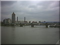
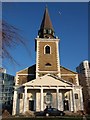
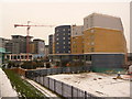
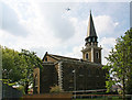
100 photos from this area
Area Information
Key information about the SW6 2QP including its size, population, and administrative classification.
- Area Type
- Postcode
- Area Size
- 1.1 hectares
- Population
- 1557
- Population Density
- 14142 people/km²
House Prices in SW6 2QP
100
Properties
£698,011
Average Sold Price
£96,000
Lowest Price
£1,268,000
Highest Price
Showing 100 properties
| Address | Type | Beds | Baths | Last Sale Price | Last Sale Date | |
|---|---|---|---|---|---|---|
| 41 Elbe Street, London, SW6 2QP | Flat | - | - | £640,000 | Jul 2023 | |
| 29 Elbe Street, London, SW6 2QP | house | 4 | 2 | £1,225,000 | Dec 2022 | |
| 10 Elbe Street, London, SW6 2QP | Terraced | 1 | 4 | £820,000 | Aug 2022 | |
| 18 Elbe Street, London, SW6 2QP | Flat | - | - | £575,000 | Jul 2022 | |
| 33 Elbe Street, London, SW6 2QP | house | 4 | 2 | £1,268,000 | May 2022 | |
| 11 Elbe Street, London, SW6 2QP | house | 3 | 2 | £1,085,000 | Feb 2022 | |
| 35 Elbe Street, London, SW6 2QP | Flat | - | - | £499,950 | Sep 2021 | |
| 5 Elbe Street, London, SW6 2QP | Terraced | 3 | 2 | £1,150,000 | Jun 2021 | |
| 45 Elbe Street, London, SW6 2QP | Flat | - | - | £430,000 | Jun 2021 | |
| 52 Elbe Street, London, SW6 2QP | house | - | - | £1,180,000 | Mar 2021 |
Page 1 of 10
Energy Efficiency in SW6 2QP
Amenities
Schools
| Rank | School | Type | Entry gender | Ages |
|---|
Explore more schools in this area
Go to Schools tabDemographics
Household Size
One person
most common
Accommodation Type
Flats
most common
Tenure
34
majority
Ethnic Group
White
most common
Religion
N/A
most common
Household Composition
N/A
most common
Age
47
median
Adults (30-64 years)
most common
Household Deprivation
N/A
with no deprivation
NS-SEC
43
in Lower managerial occupations
Explore more demographic insights in this area
Go to Demographics tabPlanning
Planning Constraints
- Flood RiskPremium
- Ramsar Wetland SitesPremium
- Area of Outstanding Natural BeautyPremium
- Protected Nature ReservePremium
- Protected WoodlandPremium