Area Overview for SW6 2AX
Photos of SW6 2AX
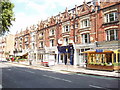

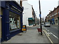
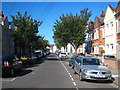
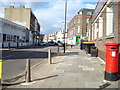
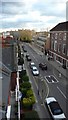
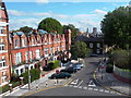
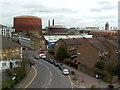

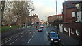
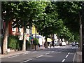
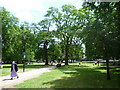
100 photos from this area
Area Information
Key information about the SW6 2AX including its size, population, and administrative classification.
- Area Type
- Postcode
- Area Size
- 5736 m²
- Population
- 1517
- Population Density
- 13401 people/km²
House Prices in SW6 2AX
34
Properties
£519,313
Average Sold Price
£190,000
Lowest Price
£1,225,000
Highest Price
Showing 34 properties
| Address | Type | Beds | Baths | Last Sale Price | Last Sale Date | |
|---|---|---|---|---|---|---|
| 31 Cheryls Close, London, SW6 2AX | Flat | 2 | 1 | £450,000 | Nov 2025 | |
| 15 Cheryls Close, London, SW6 2AX | Flat | 2 | 1 | £500,000 | Oct 2025 | |
| 7 Cheryls Close, London, SW6 2AX | Terraced | 3 | 2 | £1,225,000 | Oct 2024 | |
| 13 Cheryls Close, London, SW6 2AX | Terraced | 3 | 2 | £915,000 | Nov 2023 | |
| 20 Cheryls Close, London, SW6 2AX | Flat | 2 | 1 | £530,000 | Aug 2023 | |
| 16 Cheryls Close, London, SW6 2AX | Flat | - | - | £540,000 | Nov 2021 | |
| 18 Cheryls Close, London, SW6 2AX | Flat | - | - | £530,000 | Jun 2021 | |
| 22 Cheryls Close, London, SW6 2AX | Terraced | 3 | 2 | £725,000 | May 2020 | |
| 28 Cheryls Close, London, SW6 2AX | Flat | - | - | £575,000 | Aug 2019 | |
| 30 Cheryls Close, London, SW6 2AX | Flat | - | - | £600,000 | Apr 2014 |
Page 1 of 4
Energy Efficiency in SW6 2AX
Amenities
Schools
| Rank | School | Type | Entry gender | Ages |
|---|
Explore more schools in this area
Go to Schools tabDemographics
Household Size
Two person
most common
Accommodation Type
Flats
most common
Tenure
41
majority
Ethnic Group
White
most common
Religion
N/A
most common
Household Composition
N/A
most common
Age
47
median
Adults (30-64 years)
most common
Household Deprivation
N/A
with no deprivation
NS-SEC
55
in Lower managerial occupations
Explore more demographic insights in this area
Go to Demographics tabPlanning
Planning Constraints
- Flood RiskPremium
- Ramsar Wetland SitesPremium
- Area of Outstanding Natural BeautyPremium
- Protected Nature ReservePremium
- Protected WoodlandPremium