Area Overview for SW20 9NP
Photos of SW20 9NP
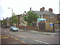
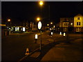
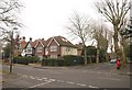
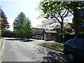
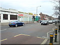
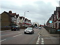
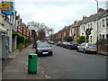
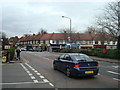

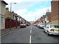
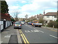
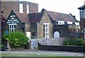
52 photos from this area
Area Information
Key information about the SW20 9NP including its size, population, and administrative classification.
- Area Type
- Postcode
- Area Size
- 2.4 hectares
- Population
- 1736
- Population Density
- 3044 people/km²
House Prices in SW20 9NP
49
Properties
£359,535
Average Sold Price
£136,000
Lowest Price
£690,000
Highest Price
Showing 49 properties
| Address | Type | Beds | Baths | Last Sale Price | Last Sale Date | |
|---|---|---|---|---|---|---|
| 21 Botsford Road, Raynes Park, SW20 9NP | Terraced | 3 | 1 | £690,000 | Aug 2022 | |
| 25 Botsford Road, Raynes Park, SW20 9NP | Retail | 4 | 1 | £625,000 | Jun 2022 | |
| 6 Botsford Road, Raynes Park, SW20 9NP | house | - | - | £427,000 | Oct 2020 | |
| 8 Botsford Road, Raynes Park, SW20 9NP | Terraced | 3 | - | £610,000 | Jan 2017 | |
| 13 Botsford Road, Raynes Park, SW20 9NP | house | - | - | £575,000 | Jul 2016 | |
| 17 Botsford Road, Raynes Park, SW20 9NP | house | - | - | £430,000 | Nov 2014 | |
| 12 Botsford Road, Raynes Park, SW20 9NP | Terraced | 4 | - | £499,950 | Oct 2014 | |
| 24 Botsford Road, Raynes Park, SW20 9NP | house | 4 | 1 | £401,450 | Nov 2013 | |
| 2E Botsford Road, Raynes Park, SW20 9NP | house | 2 | - | £310,000 | Feb 2013 | |
| 26 Botsford Road, Raynes Park, SW20 9NP | house | - | - | £390,000 | Sep 2012 |
Page 1 of 5
Energy Efficiency in SW20 9NP
Amenities
Schools
| Rank | School | Type | Entry gender | Ages |
|---|
Explore more schools in this area
Go to Schools tabDemographics
Household Size
Family (3-5 people)
most common
Accommodation Type
Houses
most common
Tenure
51
majority
Ethnic Group
White
most common
Religion
N/A
most common
Household Composition
N/A
most common
Age
47
median
Adults (30-64 years)
most common
Household Deprivation
N/A
with no deprivation
NS-SEC
40
in Lower managerial occupations
Explore more demographic insights in this area
Go to Demographics tabPlanning
Planning Constraints
- Flood RiskPremium
- Ramsar Wetland SitesPremium
- Area of Outstanding Natural BeautyPremium
- Protected Nature ReservePremium
- Protected WoodlandPremium