Area Overview for SW20 9LS
Photos of SW20 9LS
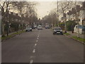
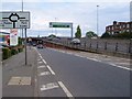
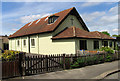
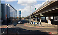
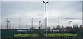
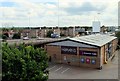

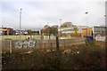
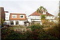
51 photos from this area
Area Information
Key information about the SW20 9LS including its size, population, and administrative classification.
- Area Type
- Postcode
- Area Size
- 1.8 hectares
- Population
- 1711
- Population Density
- 7219 people/km²
House Prices in SW20 9LS
51
Properties
£545,250
Average Sold Price
£166,750
Lowest Price
£975,000
Highest Price
Showing 51 properties
| Address | Type | Beds | Baths | Last Sale Price | Last Sale Date | |
|---|---|---|---|---|---|---|
| 124 Westway, Raynes Park, SW20 9LS | Terraced | 4 | 2 | £975,000 | Oct 2022 | |
| 126 Westway, Raynes Park, SW20 9LS | Retail | 4 | 2 | £920,000 | Feb 2022 | |
| 148 Westway, Raynes Park, SW20 9LS | Terraced | 3 | 2 | £660,000 | Oct 2021 | |
| 108 Westway, Raynes Park, SW20 9LS | house | 4 | 3 | £785,000 | Dec 2020 | |
| 136 Westway, Raynes Park, SW20 9LS | Terraced | 3 | 1 | £597,500 | Jul 2019 | |
| 140 Westway, Raynes Park, SW20 9LS | Terraced | 4 | 3 | £742,500 | Mar 2019 | |
| 156 Westway, Raynes Park, SW20 9LS | house | 3 | 1 | £640,000 | Mar 2019 | |
| 130 Westway, Raynes Park, SW20 9LS | Terraced | 3 | - | £762,000 | Aug 2018 | |
| 82 Westway, Raynes Park, SW20 9LS | Terraced | 5 | 2 | £807,500 | Feb 2017 | |
| 112 Westway, Raynes Park, SW20 9LS | Terraced | 4 | 2 | £835,000 | Feb 2016 |
Page 1 of 6
Energy Efficiency in SW20 9LS
Amenities
Schools
| Rank | School | Type | Entry gender | Ages |
|---|
Explore more schools in this area
Go to Schools tabDemographics
Household Size
Family (3-5 people)
most common
Accommodation Type
Houses
most common
Tenure
79
majority
Ethnic Group
White
most common
Religion
N/A
most common
Household Composition
N/A
most common
Age
47
median
Adults (30-64 years)
most common
Household Deprivation
N/A
with no deprivation
NS-SEC
50
in Lower managerial occupations
Explore more demographic insights in this area
Go to Demographics tabPlanning
Planning Constraints
- Flood RiskPremium
- Ramsar Wetland SitesPremium
- Area of Outstanding Natural BeautyPremium
- Protected Nature ReservePremium
- Protected WoodlandPremium