Area Overview for SW20 8PF
Photos of SW20 8PF
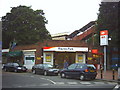
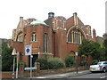
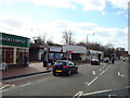
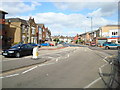
67 photos from this area
Area Information
Key information about the SW20 8PF including its size, population, and administrative classification.
- Area Type
- Postcode
- Area Size
- 1.3 hectares
- Population
- 1630
- Population Density
- 7359 people/km²
House Prices in SW20 8PF
60
Properties
£885,680
Average Sold Price
£195,000
Lowest Price
£1,810,000
Highest Price
Showing 60 properties
| Address | Type | Beds | Baths | Last Sale Price | Last Sale Date | |
|---|---|---|---|---|---|---|
| 26 Pepys Road, Raynes Park, SW20 8PF | Retail | 4 | 2 | £1,383,004 | Dec 2021 | |
| 58 Pepys Road, Raynes Park, SW20 8PF | Detached | 5 | 2 | £1,300,000 | Sep 2021 | |
| 60 Pepys Road, Raynes Park, SW20 8PF | Detached | 4 | 2 | £1,055,000 | Jun 2020 | |
| 40 Pepys Road, Raynes Park, SW20 8PF | house | - | - | £1,750,000 | Apr 2020 | |
| 66 Pepys Road, Raynes Park, SW20 8PF | house | - | - | £1,150,000 | Dec 2018 | |
| 46 Pepys Road, Raynes Park, SW20 8PF | Semi-detached | 5 | 2 | £1,530,000 | Feb 2018 | |
| 44 Pepys Road, Raynes Park, SW20 8PF | Detached | 4 | 1 | £1,810,000 | Nov 2016 | |
| 82 Pepys Road, Raynes Park, SW20 8PF | house | 3 | 1 | £1,045,000 | Aug 2016 | |
| 64 Pepys Road, Raynes Park, SW20 8PF | Terraced | 5 | 2 | £1,175,000 | Mar 2015 | |
| 74A Pepys Road, Raynes Park, SW20 8PF | Detached | 3 | 2 | £755,000 | Oct 2013 |
Page 1 of 6
Energy Efficiency in SW20 8PF
Amenities
Schools
| Rank | School | Type | Entry gender | Ages |
|---|
Explore more schools in this area
Go to Schools tabDemographics
Household Size
Family (3-5 people)
most common
Accommodation Type
Houses
most common
Tenure
77
majority
Ethnic Group
White
most common
Religion
N/A
most common
Household Composition
N/A
most common
Age
47
median
Adults (30-64 years)
most common
Household Deprivation
N/A
with no deprivation
NS-SEC
63
in Lower managerial occupations
Explore more demographic insights in this area
Go to Demographics tabPlanning
Planning Constraints
- Flood RiskPremium
- Ramsar Wetland SitesPremium
- Area of Outstanding Natural BeautyPremium
- Protected Nature ReservePremium
- Protected WoodlandPremium