Area Overview for SW2 4JR
Photos of SW2 4JR
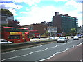
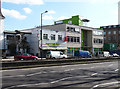
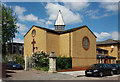
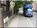
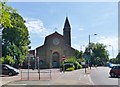
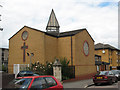
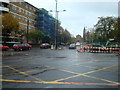
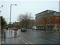
100 photos from this area
Area Information
Key information about the SW2 4JR including its size, population, and administrative classification.
- Area Type
- Postcode
- Area Size
- 4386 m²
- Population
- 2595
- Population Density
- 20353 people/km²
House Prices in SW2 4JR
20
Properties
£228,167
Average Sold Price
£80,000
Lowest Price
£380,000
Highest Price
Showing 20 properties
| Address | Type | Beds | Baths | Last Sale Price | Last Sale Date | |
|---|---|---|---|---|---|---|
| 43 Saxby Road, London, SW2 4JR | Flat | 2 | 1 | £380,000 | Jan 2017 | |
| 53 Saxby Road, London, SW2 4JR | house | 2 | - | £270,000 | Oct 2011 | |
| 65 Saxby Road, London, SW2 4JR | Terraced | - | - | £243,000 | Jan 2007 | |
| 61 Saxby Road, London, SW2 4JR | Terraced | 1 | 1 | £200,000 | Sep 2004 | |
| 59 Saxby Road, London, SW2 4JR | house | - | - | £196,000 | Jul 2003 | |
| 49 Saxby Road, London, SW2 4JR | Flat | - | - | £80,000 | Mar 2000 | |
| 69 Saxby Road, London, SW2 4JR | Maisonette | 2 | 1 | - | - | |
| 51 Saxby Road, London, SW2 4JR | Flat | - | - | - | - | |
| 45 Saxby Road, London, SW2 4JR | Flat | - | - | - | - | |
| 41 Saxby Road, London, SW2 4JR | Flat | - | - | - | - |
Page 1 of 2
Energy Efficiency in SW2 4JR
Amenities
Schools
| Rank | School | Type | Entry gender | Ages |
|---|
Explore more schools in this area
Go to Schools tabDemographics
Household Size
Two person
most common
Accommodation Type
Flats
most common
Tenure
39
majority
Ethnic Group
White
most common
Religion
N/A
most common
Household Composition
N/A
most common
Age
47
median
Adults (30-64 years)
most common
Household Deprivation
N/A
with no deprivation
NS-SEC
47
in Lower managerial occupations
Explore more demographic insights in this area
Go to Demographics tabPlanning
Planning Constraints
- Flood RiskPremium
- Ramsar Wetland SitesPremium
- Area of Outstanding Natural BeautyPremium
- Protected Nature ReservePremium
- Protected WoodlandPremium