Area Overview for SW2 4JL
Photos of SW2 4JL
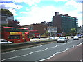
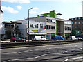
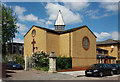
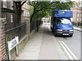
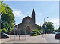
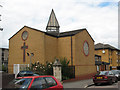
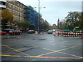
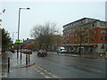
100 photos from this area
Area Information
Key information about the SW2 4JL including its size, population, and administrative classification.
- Area Type
- Postcode
- Area Size
- 3948 m²
- Population
- 2595
- Population Density
- 20353 people/km²
House Prices in SW2 4JL
38
Properties
£393,144
Average Sold Price
£6,000
Lowest Price
£630,000
Highest Price
Showing 38 properties
| Address | Type | Beds | Baths | Last Sale Price | Last Sale Date | |
|---|---|---|---|---|---|---|
| 122 Kingswood Road, London, SW2 4JL | Maisonette | 2 | 1 | £555,000 | Dec 2023 | |
| 136 Kingswood Road, London, SW2 4JL | Flat | 3 | 1 | £465,000 | Jan 2022 | |
| 112 Kingswood Road, London, SW2 4JL | Maisonette | 3 | - | £630,000 | Jan 2022 | |
| 124 Kingswood Road, London, SW2 4JL | Flat | 3 | 1 | £568,000 | Sep 2021 | |
| 130 Kingswood Road, London, SW2 4JL | Flat | - | - | £6,000 | Apr 2021 | |
| 104A Kingswood Road, London, SW2 4JL | Flat | - | - | £535,000 | Nov 2020 | |
| 132 Kingswood Road, London, SW2 4JL | Maisonette | 3 | 1 | £565,000 | Feb 2020 | |
| 110A Kingswood Road, London, SW2 4JL | Flat | - | - | £567,500 | Nov 2018 | |
| 114 Kingswood Road, London, SW2 4JL | Maisonette | 2 | 1 | £510,000 | Jun 2018 | |
| 120 Kingswood Road, London, SW2 4JL | Maisonette | - | - | £600,000 | Apr 2017 |
Page 1 of 4
Energy Efficiency in SW2 4JL
Amenities
Schools
| Rank | School | Type | Entry gender | Ages |
|---|
Explore more schools in this area
Go to Schools tabDemographics
Household Size
Two person
most common
Accommodation Type
Flats
most common
Tenure
39
majority
Ethnic Group
White
most common
Religion
N/A
most common
Household Composition
N/A
most common
Age
47
median
Adults (30-64 years)
most common
Household Deprivation
N/A
with no deprivation
NS-SEC
47
in Lower managerial occupations
Explore more demographic insights in this area
Go to Demographics tabPlanning
Planning Constraints
- Flood RiskPremium
- Ramsar Wetland SitesPremium
- Area of Outstanding Natural BeautyPremium
- Protected Nature ReservePremium
- Protected WoodlandPremium