Area Overview for SW2 4EL
Photos of SW2 4EL
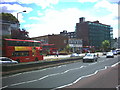
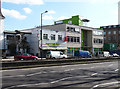
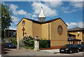
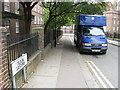
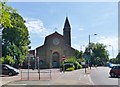
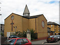

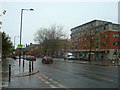
100 photos from this area
Area Information
Key information about the SW2 4EL including its size, population, and administrative classification.
- Area Type
- Postcode
- Area Size
- 3504 m²
- Population
- 2595
- Population Density
- 20353 people/km²
House Prices in SW2 4EL
19
Properties
£489,773
Average Sold Price
£200,000
Lowest Price
£865,000
Highest Price
Showing 19 properties
| Address | Type | Beds | Baths | Last Sale Price | Last Sale Date | |
|---|---|---|---|---|---|---|
| 45 Sulina Road, London, SW2 4EL | Terraced | 3 | 1 | £765,000 | Jul 2024 | |
| 43 Sulina Road, London, SW2 4EL | house | - | - | £570,000 | Jan 2022 | |
| 42 Sulina Road, London, SW2 4EL | Terraced | 4 | 2 | £505,000 | Sep 2018 | |
| 39 Sulina Road, London, SW2 4EL | house | - | - | £865,000 | Sep 2017 | |
| 37 Sulina Road, London, SW2 4EL | Terraced | 3 | - | £655,000 | Mar 2014 | |
| 34 Sulina Road, London, SW2 4EL | Detached | 3 | 2 | £582,000 | Jul 2013 | |
| 49 Sulina Road, London, SW2 4EL | house | - | - | £290,000 | Aug 2010 | |
| 41 Sulina Road, London, SW2 4EL | Terraced | 5 | 2 | £455,000 | Feb 2008 | |
| 48 Sulina Road, London, SW2 4EL | Terraced | - | - | £200,000 | Apr 2003 | |
| 44 Sulina Road, London, SW2 4EL | house | 3 | - | £208,000 | Oct 2002 |
Page 1 of 2
Energy Efficiency in SW2 4EL
Amenities
Schools
| Rank | School | Type | Entry gender | Ages |
|---|
Explore more schools in this area
Go to Schools tabDemographics
Household Size
Two person
most common
Accommodation Type
Flats
most common
Tenure
39
majority
Ethnic Group
White
most common
Religion
N/A
most common
Household Composition
N/A
most common
Age
47
median
Adults (30-64 years)
most common
Household Deprivation
N/A
with no deprivation
NS-SEC
47
in Lower managerial occupations
Explore more demographic insights in this area
Go to Demographics tabPlanning
Planning Constraints
- Flood RiskPremium
- Ramsar Wetland SitesPremium
- Area of Outstanding Natural BeautyPremium
- Protected Nature ReservePremium
- Protected WoodlandPremium