Area Overview for SW2 3TX
Photos of SW2 3TX

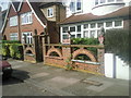
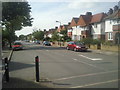
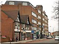
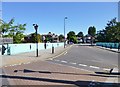

100 photos from this area
Area Information
Key information about the SW2 3TX including its size, population, and administrative classification.
- Area Type
- Postcode
- Area Size
- 9371 m²
- Population
- 1597
- Population Density
- 9907 people/km²
House Prices in SW2 3TX
29
Properties
£679,594
Average Sold Price
£125,000
Lowest Price
£1,090,000
Highest Price
Showing 29 properties
| Address | Type | Beds | Baths | Last Sale Price | Last Sale Date | |
|---|---|---|---|---|---|---|
| 149 Downton Avenue, London, SW2 3TX | house | 3 | 1 | £830,000 | Jun 2023 | |
| 125 Downton Avenue, London, SW2 3TX | Semi-detached | 4 | 1 | £1,090,000 | Nov 2022 | |
| 119 Downton Avenue, London, SW2 3TX | Terraced | 1 | 1 | £1,071,000 | Apr 2021 | |
| 105 Downton Avenue, London, SW2 3TX | house | 4 | 1 | £975,000 | Dec 2020 | |
| 143 Downton Avenue, London, SW2 3TX | house | 3 | 1 | £727,500 | Jun 2019 | |
| 137 Downton Avenue, London, SW2 3TX | Semi-detached | 3 | 1 | £750,000 | Apr 2018 | |
| 135 Downton Avenue, London, SW2 3TX | house | 4 | 1 | £860,000 | Jun 2017 | |
| 133 Downton Avenue, London, SW2 3TX | Terraced | 4 | - | £810,000 | Apr 2015 | |
| 131 Downton Avenue, London, SW2 3TX | Detached | 4 | - | £1,000,000 | Apr 2015 | |
| 115 Downton Avenue, London, SW2 3TX | Detached | 5 | 2 | £745,000 | Aug 2014 |
Page 1 of 3
Energy Efficiency in SW2 3TX
Amenities
Schools
| Rank | School | Type | Entry gender | Ages |
|---|
Explore more schools in this area
Go to Schools tabDemographics
Household Size
Family (3-5 people)
most common
Accommodation Type
Flats
most common
Tenure
56
majority
Ethnic Group
White
most common
Religion
N/A
most common
Household Composition
N/A
most common
Age
47
median
Adults (30-64 years)
most common
Household Deprivation
N/A
with no deprivation
NS-SEC
47
in Lower managerial occupations
Explore more demographic insights in this area
Go to Demographics tabPlanning
Planning Constraints
- Flood RiskPremium
- Ramsar Wetland SitesPremium
- Area of Outstanding Natural BeautyPremium
- Protected Nature ReservePremium
- Protected WoodlandPremium