Area Overview for SW2 3AF
Photos of SW2 3AF

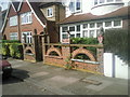
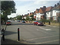
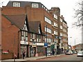
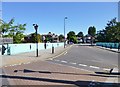
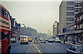
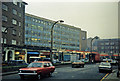
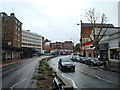
100 photos from this area
Area Information
Key information about the SW2 3AF including its size, population, and administrative classification.
- Area Type
- Postcode
- Area Size
- 5670 m²
- Population
- 1930
- Population Density
- 18702 people/km²
House Prices in SW2 3AF
42
Properties
£524,231
Average Sold Price
£87,500
Lowest Price
£950,000
Highest Price
Showing 42 properties
| Address | Type | Beds | Baths | Last Sale Price | Last Sale Date | |
|---|---|---|---|---|---|---|
| 147 Amesbury Avenue, London, SW2 3AF | house | 4 | 1 | £950,000 | Oct 2023 | |
| 133 Amesbury Avenue, London, SW2 3AF | Terraced | 4 | 1 | £850,000 | Jan 2023 | |
| 91 Amesbury Avenue, London, SW2 3AF | house | 4 | 1 | £873,271 | Dec 2019 | |
| 105 Amesbury Avenue, London, SW2 3AF | house | 5 | - | £635,000 | Jan 2014 | |
| 101 Amesbury Avenue, London, SW2 3AF | Terraced | 5 | 1 | £575,000 | Nov 2013 | |
| 129 Amesbury Avenue, London, SW2 3AF | house | - | - | £610,000 | Oct 2013 | |
| 111 Amesbury Avenue, London, SW2 3AF | house | 4 | - | £400,000 | Apr 2011 | |
| 127 Amesbury Avenue, London, SW2 3AF | Terraced | - | - | £475,000 | Mar 2010 | |
| 109 Amesbury Avenue, London, SW2 3AF | Terraced | - | - | £465,000 | Jul 2007 | |
| 113 Amesbury Avenue, London, SW2 3AF | Terraced | 6 | 2 | £210,000 | Apr 2002 |
Page 1 of 5
Energy Efficiency in SW2 3AF
Amenities
Schools
| Rank | School | Type | Entry gender | Ages |
|---|
Explore more schools in this area
Go to Schools tabDemographics
Household Size
Family (3-5 people)
most common
Accommodation Type
Flats
most common
Tenure
34
majority
Ethnic Group
White
most common
Religion
N/A
most common
Household Composition
N/A
most common
Age
47
median
Adults (30-64 years)
most common
Household Deprivation
N/A
with no deprivation
NS-SEC
41
in Lower managerial occupations
Explore more demographic insights in this area
Go to Demographics tabPlanning
Planning Constraints
- Flood RiskPremium
- Ramsar Wetland SitesPremium
- Area of Outstanding Natural BeautyPremium
- Protected Nature ReservePremium
- Protected WoodlandPremium