Area Overview for SW2 2ND
Photos of SW2 2ND
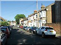
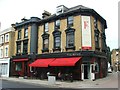
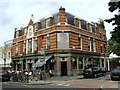
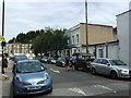
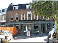
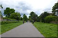
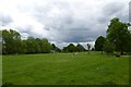
100 photos from this area
Area Information
Key information about the SW2 2ND including its size, population, and administrative classification.
- Area Type
- Postcode
- Area Size
- 5152 m²
- Population
- 1501
- Population Density
- 13950 people/km²
House Prices in SW2 2ND
46
Properties
£378,338
Average Sold Price
£80,000
Lowest Price
£990,028
Highest Price
Showing 46 properties
| Address | Type | Beds | Baths | Last Sale Price | Last Sale Date | |
|---|---|---|---|---|---|---|
| 27 Leander Road, London, SW2 2ND | Terraced | 4 | 1 | £970,000 | Aug 2022 | |
| 23 Leander Road, London, SW2 2ND | house | - | - | £990,028 | Dec 2021 | |
| 45 Leander Road, London, SW2 2ND | Terraced | 4 | - | £525,000 | Jun 2012 | |
| 9 Leander Road, London, SW2 2ND | Terraced | - | - | £460,000 | Aug 2006 | |
| 15 Leander Road, London, SW2 2ND | Terraced | 4 | 1 | £80,000 | Apr 2002 | |
| 37 Leander Road, London, SW2 2ND | house | - | - | £290,000 | May 2001 | |
| 19 Leander Road, London, SW2 2ND | house | 4 | 1 | £149,600 | Jul 1997 | |
| 41 Leander Road, London, SW2 2ND | house | 4 | - | £130,000 | Jun 1997 | |
| 35 Leander Road, London, SW2 2ND | Terraced | - | - | £97,500 | Sep 1996 | |
| 29 Leander Road, London, SW2 2ND | house | - | - | £91,250 | May 1996 |
Page 1 of 5
Energy Efficiency in SW2 2ND
Amenities
Schools
| Rank | School | Type | Entry gender | Ages |
|---|
Explore more schools in this area
Go to Schools tabDemographics
Household Size
Two person
most common
Accommodation Type
Flats
most common
Tenure
45
majority
Ethnic Group
White
most common
Religion
N/A
most common
Household Composition
N/A
most common
Age
47
median
Adults (30-64 years)
most common
Household Deprivation
N/A
with no deprivation
NS-SEC
63
in Lower managerial occupations
Explore more demographic insights in this area
Go to Demographics tabPlanning
Planning Constraints
- Flood RiskPremium
- Ramsar Wetland SitesPremium
- Area of Outstanding Natural BeautyPremium
- Protected Nature ReservePremium
- Protected WoodlandPremium