Area Overview for SW2 2HU
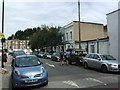
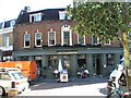
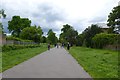
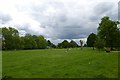
Photos of SW2 2HU
Area Information
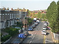
You are standing in a very specific residential cluster in South London, defined by the postcode SO2 2HU. This area is compact, covering just 7044 square metres, yet it supports a population of 1620 people. The result is an intense environment with a population density of 229,987 people per square kilometre. Living in SW2 2HU means sharing tight spaces with a significant number of neighbours. This high density is characteristic of flat-led communities where personal space can be at a premium compared to wider suburban developments. Despite the cramped footprint, the area benefits from extensive connectivity to wider London zones. You are close to major transport hubs including Herne Hill, Brixton, and Tulse Hill stations. There are also railway connections at Stockwell and Clapham South, plus underground access at Nine Elms. Daily life revolves around convenience and proximity. The concentration of residents means that local amenities, while nearby, serve a concentrated user base. You will find the area is dominated by flats rather than detached houses. This housing stock suits smaller household types who require less land. The community is tightly knit due to the sheer number of people living in a small footprint. Regardless of what you value, the physical reality of SW2 2HU is one of urban intensity within the borough of Lambeth.
- Area Type
- Postcode
- Area Size
- 7044 m²
- Population
- 1620
- Population Density
- 22161 people/km²
The property market within SW2 2HU is defined by a lack of traditional house ownership. Current figures show that only 18 percent of residents own their homes. This low penetration rate indicates that the area is primarily a rental market. If you are looking at properties here, expect to encounter leasehold flats rather than freehold houses. The accommodation type data confirms that flats are the standard housing form. This structure suits single professionals, small couples, or elderly couples who do not need extensive garden space. Buying a home here is less common than renting. Most transactions involve tenanted flats within the immediate cluster. The 7044 square metre size of the total area limits the volume of stock available to the open market. You will not find semi-detached row houses or detached bungalows within this specific postcode boundary. Instead, the stock consists of urban dwellings designed for vertical living. This has implications for mortgage lenders who may treat SW2 2HU properties differently than suburban homes. Buyers must consider the maintenance responsibilities associated with flat living in a high-density block. The market is further influenced by the broader trends in South London rental demand.
House Prices in SW2 2HU
Showing 20 properties
| Address | Type | Beds | Baths | Last Sale Price | Last Sale Date | |
|---|---|---|---|---|---|---|
| 19, Woodruff House, Tulse Hill, London, SW2 2HU | Flat | 2 | 1 | - | - | |
| 18, Woodruff House, Tulse Hill, London, SW2 2HU | Flat | 2 | 1 | - | - | |
| 17, Woodruff House, Tulse Hill, London, SW2 2HU | Flat | 2 | 1 | - | - | |
| 1, Woodruff House, Tulse Hill, London, SW2 2HU | Flat | - | - | - | - | |
| 6, Woodruff House, Tulse Hill, London, SW2 2HU | Flat | - | - | - | - | |
| 16, Woodruff House, Tulse Hill, London, SW2 2HU | Flat | - | - | - | - | |
| 4, Woodruff House, Tulse Hill, London, SW2 2HU | Flat | - | - | - | - | |
| 13, Woodruff House, Tulse Hill, London, SW2 2HU | Flat | - | - | - | - | |
| 15, Woodruff House, Tulse Hill, London, SW2 2HU | Flat | - | - | - | - | |
| 2, Woodruff House, Tulse Hill, London, SW2 2HU | Flat | - | - | - | - |
Energy Efficiency in SW2 2HU
Daily life in SW2 2HU is serviced by a dense network of amenities. You have access to several major supermarkets including Sainsburys Brixton, Tesco Brixton Tulse, and Sainsburys Brixton. These five retail options are located within practical walking distance. The area functions as a convenient stop for daily groceries and household essentials. Transport access is extensive with five rail stations nearby. You can reach Stockwell Station, Clapham South, and Nine Elms Underground Station easily. For river travel, five ferry destinations are accessible including Vauxhall St George Wharf Pier, Battersea Power Station Pier, and Millbank Pier. Bus connectivity is also present with three noted stops mentioned in the data, such as Victoria Coach Station Arrivals. This ensures you can reach London-wide destinations quickly. The lifestyle here is urban and oriented around public transport and retail rather than parks or independent boutiques within the immediate 7044 square metres. You do not have vast amounts of green space listed in the immediate area data, so recreation likely involves trips to nearby zones like Brixton Park. The character of SW2 2HU is one of convenience. You spend your days navigating a compact postcode that acts as a sleeping quarter for people working and shopping in wider London.
Amenities
Schools
Families residing near or considering SW2 2HU have several primary school options within practical reach. You will find two institutions named Brockwell Junior School and Brockwell Infant School. These establishments serve the younger demographic in the vicinity. Another primary option is Jubilee Primary School, which holds a good Ofsted rating. This rating distinction is important for parents evaluating educational quality. Orchard Centre is also listed as a nearby school, though it functions as an 'other' type rather than a standard primary or secondary institution. The mix of school types means you will find both early years and lower school provisions close by. Jubilee Primary School's good rating provides reassurance regarding educational standards. You do not have secondary schools explicitly listed in the immediate data for this specific postcode, so prospective homebuyers should look to establish schools beyond SW2 2HU. The presence of multiple institutions indicates a cluster of families requiring schooling facilities. When you plan your move to SW2 2HU, you should verify the catchment boundaries for Brockwell Junior and Infant schools. These schools anchor the educational landscape for those living in this dense residential hub.
| Rank | School | Type | Entry gender | Ages |
|---|
Explore more schools in this area
Go to Schools tabDemographics
The community profile of SW2 2HU reveals a mature population. The median age is 47 years old, indicating a neighbourhood where many residents have established careers or are approaching retirement. The data categorises the most common age range among adults as those between 30 and 64 years old. This age group forms the core of the local community. Home ownership figures for this specific postcode are recorded at 18 percent. This statistic suggests that the vast majority of residents rent their accommodation. Ownership levels are low, which points toward a market driven by leaseholds and managed estates rather than freehold residential properties. The predominant type of accommodation in SW2 2HU is flats. This aligns with the low home ownership rate and the high population density you noted earlier. The demographic makeup is diverse, with black_total identified as the predominant ethnic group within this cluster. For families looking at this area, school-related decisions often hinge on local catchment zones. Proximity to quality education influences the demand for rental properties. The combination of an aging population, low ownership, and a focus on flat living creates a specific character. This is not a typical family suburb. Instead, it is an inner-city zone where tenanted flats accommodate a large portion of the adult population.
Household Size
Accommodation Type
Tenure
Ethnic Group
Religion
Household Composition
Age
Household Deprivation
NS-SEC
Explore more demographic insights in this area
Go to Demographics tabPlanning
Planning Constraints
- Flood RiskPremium
- Ramsar Wetland SitesPremium
- Area of Outstanding Natural BeautyPremium
- Protected Nature ReservePremium
- Protected WoodlandPremium