Area Overview for SW1X 9DU
Photos of SW1X 9DU
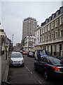
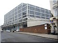

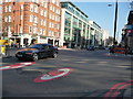
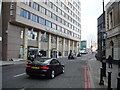

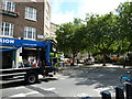
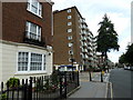
100 photos from this area
Area Information
Key information about the SW1X 9DU including its size, population, and administrative classification.
- Area Type
- Postcode
- Area Size
- 1945 m²
- Population
- 1117
- Population Density
- 8994 people/km²
House Prices in SW1X 9DU
15
Properties
£1,859,144
Average Sold Price
£480,000
Lowest Price
£3,400,000
Highest Price
Showing 15 properties
| Address | Type | Beds | Baths | Last Sale Price | Last Sale Date | |
|---|---|---|---|---|---|---|
| 91 Cadogan Lane, London, SW1X 9DU | Terraced | 3 | 3 | £2,625,000 | Aug 2024 | |
| 81 Cadogan Lane, London, SW1X 9DU | Terraced | 3 | 3 | £1,695,000 | Jun 2021 | |
| 83 Cadogan Lane, London, SW1X 9DU | Terraced | 2 | 2 | £3,183,000 | Jul 2020 | |
| 71 Cadogan Lane, London, SW1X 9DU | Terraced | 3 | 3 | £3,400,000 | Sep 2019 | |
| 79 Cadogan Lane, London, SW1X 9DU | house | - | - | £1,767,650 | May 2017 | |
| 73 Cadogan Lane, London, SW1X 9DU | Terraced | 4 | 2 | £1,222,000 | May 2007 | |
| 89 Cadogan Lane, London, SW1X 9DU | Detached | 3 | 2 | £500,500 | Apr 1996 | |
| 85 Cadogan Lane, London, SW1X 9DU | Detached | 4 | 2 | £480,000 | Dec 1995 | |
| First Floor Flat (north), 97 Cadogan Lane, London, SW1X 9DU | Retail | 2 | 2 | - | - | |
| 75 Cadogan Lane, London, SW1X 9DU | house | 4 | 2 | - | - |
Page 1 of 2
Energy Efficiency in SW1X 9DU
Amenities
Schools
| Rank | School | Type | Entry gender | Ages |
|---|
Explore more schools in this area
Go to Schools tabDemographics
Household Size
One person
most common
Accommodation Type
Flats
most common
Tenure
35
majority
Ethnic Group
White
most common
Religion
N/A
most common
Household Composition
N/A
most common
Age
47
median
Adults (30-64 years)
most common
Household Deprivation
N/A
with no deprivation
NS-SEC
52
in Lower managerial occupations
Explore more demographic insights in this area
Go to Demographics tabPlanning
Planning Constraints
- Flood RiskPremium
- Ramsar Wetland SitesPremium
- Area of Outstanding Natural BeautyPremium
- Protected Nature ReservePremium
- Protected WoodlandPremium