Area Overview for SW1W 9NY
Photos of SW1W 9NY
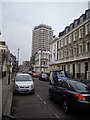
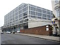
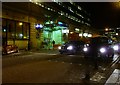
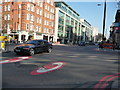

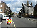
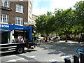
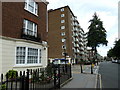
100 photos from this area
Area Information
Key information about the SW1W 9NY including its size, population, and administrative classification.
- Area Type
- Postcode
- Area Size
- 1844 m²
- Population
- 1065
- Population Density
- 4507 people/km²
House Prices in SW1W 9NY
16
Properties
£3,993,450
Average Sold Price
£120,000
Lowest Price
£25,515,000
Highest Price
Showing 16 properties
| Address | Type | Beds | Baths | Last Sale Price | Last Sale Date | |
|---|---|---|---|---|---|---|
| 46 Ebury Mews, London, SW1W 9NY | house | - | - | £25,515,000 | Nov 2023 | |
| 52 Ebury Mews, London, SW1W 9NY | Terraced | 3 | 2 | £2,650,000 | Dec 2021 | |
| 48 Ebury Mews, London, SW1W 9NY | Terraced | 2 | 2 | £2,215,000 | Apr 2021 | |
| 59 Ebury Mews, London, SW1W 9NY | house | 2 | 2 | £1,550,000 | Oct 2010 | |
| 47 Ebury Mews, London, SW1W 9NY | house | - | - | £1,700,000 | Dec 2009 | |
| 51 Ebury Mews, London, SW1W 9NY | Terraced | - | - | £1,393,000 | May 2006 | |
| 60 Ebury Mews, London, SW1W 9NY | Terraced | - | - | £875,000 | Nov 2000 | |
| 55 Ebury Mews, London, SW1W 9NY | Flat | 2 | 2 | £636,500 | Oct 1998 | |
| 56 Ebury Mews, London, SW1W 9NY | Terraced | - | - | £3,280,000 | Oct 1998 | |
| 58 Ebury Mews, London, SW1W 9NY | house | 2 | 2 | £120,000 | Sep 1996 |
Page 1 of 2
Energy Efficiency in SW1W 9NY
Amenities
Schools
| Rank | School | Type | Entry gender | Ages |
|---|
Explore more schools in this area
Go to Schools tabDemographics
Household Size
Two person
most common
Accommodation Type
Houses
most common
Tenure
54
majority
Ethnic Group
White
most common
Religion
N/A
most common
Household Composition
N/A
most common
Age
47
median
Adults (30-64 years)
most common
Household Deprivation
N/A
with no deprivation
NS-SEC
43
in Lower managerial occupations
Explore more demographic insights in this area
Go to Demographics tabPlanning
Planning Constraints
- Flood RiskPremium
- Ramsar Wetland SitesPremium
- Area of Outstanding Natural BeautyPremium
- Protected Nature ReservePremium
- Protected WoodlandPremium