Area Overview for SW1W 9JE
Photos of SW1W 9JE
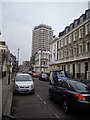
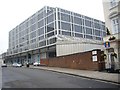
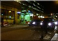
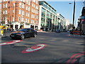

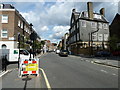
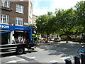
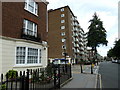
100 photos from this area
Area Information
Key information about the SW1W 9JE including its size, population, and administrative classification.
- Area Type
- Postcode
- Area Size
- 895 m²
- Population
- 1319
- Population Density
- 7122 people/km²
House Prices in SW1W 9JE
9
Properties
£2,333,581
Average Sold Price
£460,000
Lowest Price
£4,300,000
Highest Price
Showing 9 properties
| Address | Type | Beds | Baths | Last Sale Price | Last Sale Date | |
|---|---|---|---|---|---|---|
| 39 Chester Row, London, SW1W 9JE | Detached | 3 | 3 | £3,950,000 | May 2022 | |
| 31 Chester Row, London, SW1W 9JE | Terraced | 3 | - | £2,140,000 | Mar 2017 | |
| 35 Chester Row, London, SW1W 9JE | house | - | - | £1,793,350 | Dec 2015 | |
| 35A Chester Row, London, SW1W 9JE | Flat | - | - | £1,965,300 | Oct 2015 | |
| 37 Chester Row, London, SW1W 9JE | house | 5 | - | £4,300,000 | Feb 2013 | |
| 29 Chester Row, London, SW1W 9JE | Terraced | 3 | 3 | £2,960,000 | Sep 2009 | |
| 33 Chester Row, London, SW1W 9JE | Terraced | 3 | 2 | £1,100,000 | Aug 2003 | |
| 41 Chester Row, London, SW1W 9JE | house | 2 | - | £460,000 | Mar 1998 | |
| 35-35-A Chester Row, London, SW1W 9JE | Terraced | 6 | 6 | - | - |
Energy Efficiency in SW1W 9JE
Amenities
Schools
| Rank | School | Type | Entry gender | Ages |
|---|
Explore more schools in this area
Go to Schools tabDemographics
Household Size
One person
most common
Accommodation Type
Houses
most common
Tenure
57
majority
Ethnic Group
White
most common
Religion
N/A
most common
Household Composition
N/A
most common
Age
47
median
Adults (30-64 years)
most common
Household Deprivation
N/A
with no deprivation
NS-SEC
54
in Lower managerial occupations
Explore more demographic insights in this area
Go to Demographics tabPlanning
Planning Constraints
- Flood RiskPremium
- Ramsar Wetland SitesPremium
- Area of Outstanding Natural BeautyPremium
- Protected Nature ReservePremium
- Protected WoodlandPremium