Area Overview for SW19 8TR
Photos of SW19 8TR
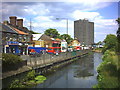

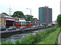

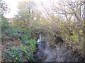
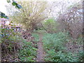


100 photos from this area
Area Information
Key information about the SW19 8TR including its size, population, and administrative classification.
- Area Type
- Postcode
- Area Size
- 6599 m²
- Population
- 1757
- Population Density
- 12834 people/km²
House Prices in SW19 8TR
57
Properties
£381,533
Average Sold Price
£76,500
Lowest Price
£720,000
Highest Price
Showing 57 properties
| Address | Type | Beds | Baths | Last Sale Price | Last Sale Date | |
|---|---|---|---|---|---|---|
| 160A Haydons Road, South Wimbledon, London, SW19 8TR | Flat | 3 | 1 | £525,000 | Feb 2025 | |
| 158 Haydons Road, South Wimbledon, London, SW19 8TR | Retail | 2 | 1 | £510,000 | Aug 2024 | |
| 204 Haydons Road, South Wimbledon, London, SW19 8TR | Terraced | 3 | 2 | £640,000 | Feb 2022 | |
| 224 Haydons Road, South Wimbledon, London, SW19 8TR | house | - | - | £650,000 | Dec 2021 | |
| 168 Haydons Road, South Wimbledon, London, SW19 8TR | house | - | - | £720,000 | Dec 2021 | |
| 160 Haydons Road, South Wimbledon, London, SW19 8TR | Semi-detached | 3 | 1 | £364,000 | Sep 2016 | |
| 174 Haydons Road, South Wimbledon, London, SW19 8TR | house | - | - | £510,000 | Aug 2015 | |
| 216A Haydons Road, South Wimbledon, London, SW19 8TR | Flat | - | - | £294,000 | Jul 2015 | |
| 164 Haydons Road, South Wimbledon, London, SW19 8TR | Terraced | 4 | 3 | £377,500 | Oct 2013 | |
| 170 Haydons Road, South Wimbledon, London, SW19 8TR | Terraced | 5 | - | £351,000 | Jul 2013 |
Page 1 of 6
Energy Efficiency in SW19 8TR
Amenities
Schools
| Rank | School | Type | Entry gender | Ages |
|---|
Explore more schools in this area
Go to Schools tabDemographics
Household Size
Family (3-5 people)
most common
Accommodation Type
Houses
most common
Tenure
58
majority
Ethnic Group
White
most common
Religion
N/A
most common
Household Composition
N/A
most common
Age
47
median
Adults (30-64 years)
most common
Household Deprivation
N/A
with no deprivation
NS-SEC
63
in Lower managerial occupations
Explore more demographic insights in this area
Go to Demographics tabPlanning
Planning Constraints
- Flood RiskPremium
- Ramsar Wetland SitesPremium
- Area of Outstanding Natural BeautyPremium
- Protected Nature ReservePremium
- Protected WoodlandPremium