Area Overview for SW19 8HJ
Photos of SW19 8HJ

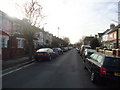
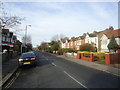
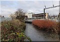
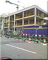

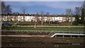
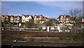
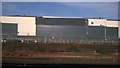
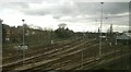
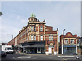
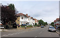
99 photos from this area
Area Information
Key information about the SW19 8HJ including its size, population, and administrative classification.
- Area Type
- Postcode
- Area Size
- 6324 m²
- Population
- 1089
- Population Density
- 2867 people/km²
House Prices in SW19 8HJ
31
Properties
£342,663
Average Sold Price
£59,950
Lowest Price
£685,000
Highest Price
Showing 31 properties
| Address | Type | Beds | Baths | Last Sale Price | Last Sale Date | |
|---|---|---|---|---|---|---|
| 172 Durnsford Road, Wimbledon Park, London, SW19 8HJ | house | 4 | 2 | £685,000 | Dec 2023 | |
| 180 Durnsford Road, Wimbledon Park, London, SW19 8HJ | house | - | - | £475,000 | Dec 2022 | |
| 160 Durnsford Road, Wimbledon Park, London, SW19 8HJ | house | - | - | £532,000 | Sep 2021 | |
| Former, 146 Durnsford Road, Wimbledon Park, London, SW19 8HJ | Semi-detached | - | - | £170,000 | Jun 2021 | |
| 166 Durnsford Road, Wimbledon Park, London, SW19 8HJ | Terraced | 4 | 2 | £605,000 | May 2020 | |
| 152 Durnsford Road, Wimbledon Park, London, SW19 8HJ | Terraced | 4 | 2 | £495,000 | Mar 2019 | |
| 150 Durnsford Road, Wimbledon Park, London, SW19 8HJ | house | 3 | - | £682,000 | Jun 2018 | |
| 178 Durnsford Road, Wimbledon Park, London, SW19 8HJ | Terraced | 4 | 2 | £375,000 | Sep 2015 | |
| 168 Durnsford Road, Wimbledon Park, London, SW19 8HJ | house | - | - | £250,000 | Dec 2012 | |
| FORMER, 138 DURNSFORD ROAD, Wimbledon Park, London, SW19 8HJ | Flat | 4 | 2 | £246,000 | Oct 2004 |
Page 1 of 4
Energy Efficiency in SW19 8HJ
Amenities
Schools
| Rank | School | Type | Entry gender | Ages |
|---|
Explore more schools in this area
Go to Schools tabDemographics
Household Size
Family (3-5 people)
most common
Accommodation Type
Houses
most common
Tenure
48
majority
Ethnic Group
White
most common
Religion
N/A
most common
Household Composition
N/A
most common
Age
47
median
Adults (30-64 years)
most common
Household Deprivation
N/A
with no deprivation
NS-SEC
39
in Lower managerial occupations
Explore more demographic insights in this area
Go to Demographics tabPlanning
Planning Constraints
- Flood RiskPremium
- Ramsar Wetland SitesPremium
- Area of Outstanding Natural BeautyPremium
- Protected Nature ReservePremium
- Protected WoodlandPremium