Area Overview for SW19 7QN
Photos of SW19 7QN

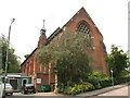
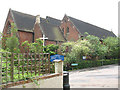
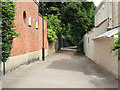

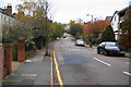
100 photos from this area
Area Information
Key information about the SW19 7QN including its size, population, and administrative classification.
- Area Type
- Postcode
- Area Size
- 5867 m²
- Population
- 1408
- Population Density
- 7844 people/km²
House Prices in SW19 7QN
56
Properties
£438,333
Average Sold Price
£86,000
Lowest Price
£772,500
Highest Price
Showing 56 properties
| Address | Type | Beds | Baths | Last Sale Price | Last Sale Date | |
|---|---|---|---|---|---|---|
| Flat 26, Woodside House, Woodside, Wimbledon, SW19 7QN | Flat | 1 | 1 | £450,000 | Jul 2025 | |
| Flat 35, Woodside House, Woodside, Wimbledon, SW19 7QN | Flat | 2 | 1 | £440,000 | Mar 2025 | |
| Flat 36, Woodside House, Woodside, Wimbledon, SW19 7QN | Flat | - | - | £750,000 | Jun 2024 | |
| Flat 55, Woodside House, Woodside, Wimbledon, SW19 7QN | Flat | - | - | £562,000 | May 2024 | |
| Flat 54, Woodside House, Woodside, Wimbledon, SW19 7QN | Flat | 2 | 2 | £370,000 | Sep 2023 | |
| Flat 45, Woodside House, Woodside, Wimbledon, SW19 7QN | Flat | 2 | - | £432,000 | Sep 2023 | |
| Flat 41, Woodside House, Woodside, Wimbledon, SW19 7QN | Flat | - | - | £675,000 | Dec 2022 | |
| Flat 34, Woodside House, Woodside, Wimbledon, SW19 7QN | Flat | 3 | 2 | £700,000 | Jun 2022 | |
| Flat 42, Woodside House, Woodside, Wimbledon, SW19 7QN | Flat | 2 | 1 | £455,000 | Mar 2022 | |
| Flat 40, Woodside House, Woodside, Wimbledon, SW19 7QN | Flat | - | - | £393,000 | Mar 2022 |
Page 1 of 6
Energy Efficiency in SW19 7QN
Amenities
Schools
| Rank | School | Type | Entry gender | Ages |
|---|
Explore more schools in this area
Go to Schools tabDemographics
Household Size
One person
most common
Accommodation Type
Flats
most common
Tenure
43
majority
Ethnic Group
White
most common
Religion
N/A
most common
Household Composition
N/A
most common
Age
47
median
Adults (30-64 years)
most common
Household Deprivation
N/A
with no deprivation
NS-SEC
64
in Lower managerial occupations
Explore more demographic insights in this area
Go to Demographics tabPlanning
Planning Constraints
- Flood RiskPremium
- Ramsar Wetland SitesPremium
- Area of Outstanding Natural BeautyPremium
- Protected Nature ReservePremium
- Protected WoodlandPremium