Area Overview for SW19 6SR
Photos of SW19 6SR
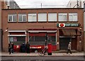
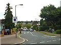
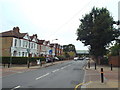
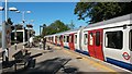
80 photos from this area
Area Information
Key information about the SW19 6SR including its size, population, and administrative classification.
- Area Type
- Postcode
- Area Size
- 7504 m²
- Population
- 1655
- Population Density
- 19988 people/km²
House Prices in SW19 6SR
54
Properties
£236,769
Average Sold Price
£79,000
Lowest Price
£385,000
Highest Price
Showing 54 properties
| Address | Type | Beds | Baths | Last Sale Price | Last Sale Date | |
|---|---|---|---|---|---|---|
| 104 Southmead Road, London, SW19 6SR | Flat | - | - | £300,000 | Mar 2022 | |
| 28 Southmead Road, London, SW19 6SR | Flat | - | - | £360,000 | Sep 2021 | |
| 96 Southmead Road, London, SW19 6SR | Flat | - | - | £375,000 | Jun 2021 | |
| 6 Southmead Road, London, SW19 6SR | Maisonette | 3 | 1 | £385,000 | Dec 2017 | |
| 46 Southmead Road, London, SW19 6SR | Flat | - | - | £247,000 | Jul 2013 | |
| 12 Southmead Road, London, SW19 6SR | Flat | 3 | - | £245,000 | Jun 2011 | |
| 72 Southmead Road, London, SW19 6SR | Flat | - | - | £195,000 | Jan 2011 | |
| 60 Southmead Road, London, SW19 6SR | Flat | - | - | £216,000 | Jun 2007 | |
| 2 Southmead Road, London, SW19 6SR | Flat | - | - | £272,500 | Jun 2004 | |
| 68 Southmead Road, London, SW19 6SR | Flat | - | - | £148,500 | Aug 2003 |
Page 1 of 6
Energy Efficiency in SW19 6SR
Amenities
Schools
| Rank | School | Type | Entry gender | Ages |
|---|
Explore more schools in this area
Go to Schools tabDemographics
Household Size
Family (3-5 people)
most common
Accommodation Type
Flats
most common
Tenure
22
majority
Ethnic Group
White
most common
Religion
N/A
most common
Household Composition
N/A
most common
Age
47
median
Adults (30-64 years)
most common
Household Deprivation
N/A
with no deprivation
NS-SEC
26
in Lower managerial occupations
Explore more demographic insights in this area
Go to Demographics tabPlanning
Planning Constraints
- Flood RiskPremium
- Ramsar Wetland SitesPremium
- Area of Outstanding Natural BeautyPremium
- Protected Nature ReservePremium
- Protected WoodlandPremium