Area Overview for SW19 6LB
Photos of SW19 6LB
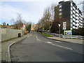
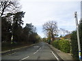
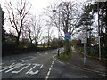
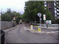
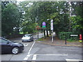
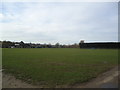
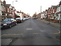
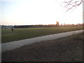
100 photos from this area
Area Information
Key information about the SW19 6LB including its size, population, and administrative classification.
- Area Type
- Postcode
- Area Size
- 5687 m²
- Population
- 1662
- Population Density
- 10184 people/km²
House Prices in SW19 6LB
13
Properties
£673,563
Average Sold Price
£194,000
Lowest Price
£1,245,000
Highest Price
Showing 13 properties
| Address | Type | Beds | Baths | Last Sale Price | Last Sale Date | |
|---|---|---|---|---|---|---|
| 61 Albert Drive, London, SW19 6LB | Terraced | 5 | 3 | £1,245,000 | May 2024 | |
| 69 Albert Drive, London, SW19 6LB | Terraced | 4 | - | £940,000 | Apr 2021 | |
| 67 Albert Drive, London, SW19 6LB | Detached | 4 | 2 | £900,000 | Sep 2020 | |
| 63A Albert Drive, London, SW19 6LB | Detached | 3 | 2 | £635,000 | Dec 2009 | |
| 75 Albert Drive, London, SW19 6LB | Detached | 7 | 3 | £1,037,500 | Jul 2004 | |
| 71 Albert Drive, London, SW19 6LB | Terraced | - | - | £225,000 | Jan 1998 | |
| 59A Albert Drive, London, SW19 6LB | Terraced | 3 | 2 | £194,000 | May 1997 | |
| 59 Albert Drive, London, SW19 6LB | Terraced | 1 | 3 | £212,000 | Oct 1995 | |
| 65 Albert Drive, London, SW19 6LB | Terraced | - | - | - | - | |
| 61A Albert Drive, London, SW19 6LB | Terraced | - | - | - | - |
Page 1 of 2
Energy Efficiency in SW19 6LB
Amenities
Schools
| Rank | School | Type | Entry gender | Ages |
|---|
Explore more schools in this area
Go to Schools tabDemographics
Household Size
Family (3-5 people)
most common
Accommodation Type
Flats
most common
Tenure
47
majority
Ethnic Group
White
most common
Religion
N/A
most common
Household Composition
N/A
most common
Age
47
median
Adults (30-64 years)
most common
Household Deprivation
N/A
with no deprivation
NS-SEC
43
in Lower managerial occupations
Explore more demographic insights in this area
Go to Demographics tabPlanning
Planning Constraints
- Flood RiskPremium
- Ramsar Wetland SitesPremium
- Area of Outstanding Natural BeautyPremium
- Protected Nature ReservePremium
- Protected WoodlandPremium