Area Overview for SW19 2HG
Photos of SW19 2HG


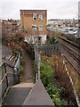
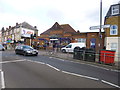
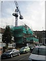
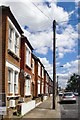


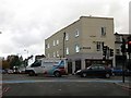
72 photos from this area
Area Information
Key information about the SW19 2HG including its size, population, and administrative classification.
- Area Type
- Postcode
- Area Size
- 1.2 hectares
- Population
- 1551
- Population Density
- 12818 people/km²
House Prices in SW19 2HG
69
Properties
£456,768
Average Sold Price
£69,473
Lowest Price
£865,000
Highest Price
Showing 69 properties
| Address | Type | Beds | Baths | Last Sale Price | Last Sale Date | |
|---|---|---|---|---|---|---|
| 70 Marlborough Road, Colliers Wood, SW19 2HG | Semi-detached | 5 | 2 | £840,000 | May 2024 | |
| 34 Marlborough Road, Colliers Wood, SW19 2HG | Terraced | 3 | 1 | £700,000 | May 2022 | |
| 48 Marlborough Road, Colliers Wood, SW19 2HG | Terraced | 3 | 2 | £865,000 | Jan 2022 | |
| 40 Marlborough Road, Colliers Wood, SW19 2HG | Terraced | 4 | - | £780,000 | Aug 2021 | |
| 42 Marlborough Road, Colliers Wood, SW19 2HG | Terraced | 4 | 2 | £760,000 | May 2019 | |
| 54 Marlborough Road, Colliers Wood, SW19 2HG | Terraced | 3 | 1 | £637,500 | Aug 2017 | |
| 58 Marlborough Road, Colliers Wood, SW19 2HG | house | 4 | 2 | £605,000 | Apr 2017 | |
| 12 Marlborough Road, Colliers Wood, SW19 2HG | Semi-detached | 3 | 1 | £720,000 | Mar 2017 | |
| 78 Marlborough Road, Colliers Wood, SW19 2HG | Detached | 4 | 2 | £620,000 | May 2015 | |
| 56 Marlborough Road, Colliers Wood, SW19 2HG | house | 4 | - | £475,000 | Dec 2013 |
Page 1 of 7
Energy Efficiency in SW19 2HG
Amenities
Schools
| Rank | School | Type | Entry gender | Ages |
|---|
Explore more schools in this area
Go to Schools tabDemographics
Household Size
Two person
most common
Accommodation Type
Houses
most common
Tenure
59
majority
Ethnic Group
White
most common
Religion
N/A
most common
Household Composition
N/A
most common
Age
47
median
Adults (30-64 years)
most common
Household Deprivation
N/A
with no deprivation
NS-SEC
47
in Lower managerial occupations
Explore more demographic insights in this area
Go to Demographics tabPlanning
Planning Constraints
- Flood RiskPremium
- Ramsar Wetland SitesPremium
- Area of Outstanding Natural BeautyPremium
- Protected Nature ReservePremium
- Protected WoodlandPremium