Area Overview for SW19 1LS
Photos of SW19 1LS
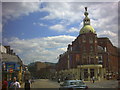
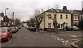
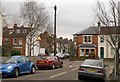
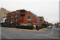
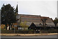
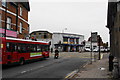
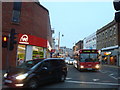
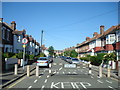
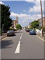

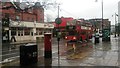
93 photos from this area
Area Information
Key information about the SW19 1LS including its size, population, and administrative classification.
- Area Type
- Postcode
- Area Size
- 1528 m²
- Population
- 1792
- Population Density
- 11682 people/km²
House Prices in SW19 1LS
12
Properties
£545,095
Average Sold Price
£25,000
Lowest Price
£1,090,000
Highest Price
Showing 12 properties
| Address | Type | Beds | Baths | Last Sale Price | Last Sale Date | |
|---|---|---|---|---|---|---|
| 1 Harcourt Road, Wimbledon, SW19 1LS | Terraced | 4 | 2 | £665,000 | Feb 2024 | |
| 6 Harcourt Road, Wimbledon, SW19 1LS | house | 2 | - | £1,090,000 | Jun 2022 | |
| 3 Harcourt Road, Wimbledon, SW19 1LS | house | 2 | - | £785,000 | Dec 2021 | |
| 10 Harcourt Road, Wimbledon, SW19 1LS | Terraced | 3 | - | £795,000 | Oct 2018 | |
| 4 Harcourt Road, Wimbledon, SW19 1LS | Terraced | 2 | 1 | £675,000 | Mar 2017 | |
| 5 Harcourt Road, Wimbledon, SW19 1LS | Terraced | 4 | 2 | £825,000 | Oct 2014 | |
| 11 Harcourt Road, Wimbledon, SW19 1LS | Terraced | - | - | £283,000 | Apr 2003 | |
| 7 Harcourt Road, Wimbledon, SW19 1LS | house | 2 | - | £189,950 | Apr 1999 | |
| 2 Harcourt Road, Wimbledon, SW19 1LS | Terraced | 3 | 1 | £25,000 | Nov 1997 | |
| 8 Harcourt Road, Wimbledon, SW19 1LS | Terraced | 2 | 1 | £118,000 | Aug 1996 |
Page 1 of 2
Energy Efficiency in SW19 1LS
Amenities
Schools
| Rank | School | Type | Entry gender | Ages |
|---|
Explore more schools in this area
Go to Schools tabDemographics
Household Size
Two person
most common
Accommodation Type
Flats
most common
Tenure
50
majority
Ethnic Group
White
most common
Religion
N/A
most common
Household Composition
N/A
most common
Age
47
median
Adults (30-64 years)
most common
Household Deprivation
N/A
with no deprivation
NS-SEC
59
in Lower managerial occupations
Explore more demographic insights in this area
Go to Demographics tabPlanning
Planning Constraints
- Flood RiskPremium
- Ramsar Wetland SitesPremium
- Area of Outstanding Natural BeautyPremium
- Protected Nature ReservePremium
- Protected WoodlandPremium