Area Overview for SW18 4RU
Photos of SW18 4RU

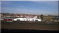
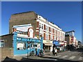
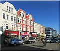
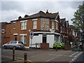
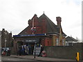
100 photos from this area
Area Information
Key information about the SW18 4RU including its size, population, and administrative classification.
- Area Type
- Postcode
- Area Size
- 3361 m²
- Population
- 2146
- Population Density
- 15039 people/km²
House Prices in SW18 4RU
27
Properties
£801,438
Average Sold Price
£467,000
Lowest Price
£1,117,500
Highest Price
Showing 27 properties
| Address | Type | Beds | Baths | Last Sale Price | Last Sale Date | |
|---|---|---|---|---|---|---|
| 136 Ravensbury Road, London, SW18 4RU | Maisonette | 2 | 2 | £650,000 | Jan 2025 | |
| 152 Ravensbury Road, London, SW18 4RU | Flat | 1 | 1 | £467,000 | Feb 2024 | |
| 126 Ravensbury Road, London, SW18 4RU | Terraced | 4 | 2 | £1,117,500 | Jul 2023 | |
| 144 Ravensbury Road, London, SW18 4RU | Flat | 2 | 1 | £625,000 | Apr 2022 | |
| 122 Ravensbury Road, London, SW18 4RU | Maisonette | 1 | 1 | £942,000 | Feb 2021 | |
| 124 Ravensbury Road, London, SW18 4RU | Maisonette | 2 | 1 | £1,065,000 | Dec 2019 | |
| 132 Ravensbury Road, London, SW18 4RU | Terraced | 3 | 2 | £985,000 | Mar 2016 | |
| 130 Ravensbury Road, London, SW18 4RU | Terraced | 3 | 1 | £560,000 | May 2012 | |
| 150A Ravensbury Road, London, SW18 4RU | Flat | 2 | 1 | - | - | |
| 144A Ravensbury Road, London, SW18 4RU | Flat | - | - | - | - |
Page 1 of 3
Energy Efficiency in SW18 4RU
Amenities
Schools
| Rank | School | Type | Entry gender | Ages |
|---|
Explore more schools in this area
Go to Schools tabDemographics
Household Size
Two person
most common
Accommodation Type
Flats
most common
Tenure
55
majority
Ethnic Group
White
most common
Religion
N/A
most common
Household Composition
N/A
most common
Age
47
median
Adults (30-64 years)
most common
Household Deprivation
N/A
with no deprivation
NS-SEC
71
in Lower managerial occupations
Explore more demographic insights in this area
Go to Demographics tabPlanning
Planning Constraints
- Flood RiskPremium
- Ramsar Wetland SitesPremium
- Area of Outstanding Natural BeautyPremium
- Protected Nature ReservePremium
- Protected WoodlandPremium