Area Overview for SW18 3QS
Photos of SW18 3QS
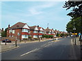
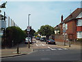
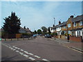
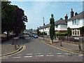
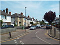
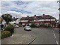
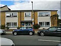
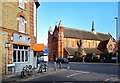
71 photos from this area
Area Information
Key information about the SW18 3QS including its size, population, and administrative classification.
- Area Type
- Postcode
- Area Size
- 8684 m²
- Population
- 1687
- Population Density
- 14916 people/km²
House Prices in SW18 3QS
68
Properties
£591,381
Average Sold Price
£3,500
Lowest Price
£960,000
Highest Price
Showing 68 properties
| Address | Type | Beds | Baths | Last Sale Price | Last Sale Date | |
|---|---|---|---|---|---|---|
| 50A Quinton Street, London, SW18 3QS | Maisonette | 4 | 3 | £950,000 | Dec 2025 | |
| 18 Quinton Street, London, SW18 3QS | Flat | 2 | 1 | £690,000 | Mar 2025 | |
| 12A Quinton Street, London, SW18 3QS | Maisonette | 4 | 2 | £960,000 | Feb 2025 | |
| 18A Quinton Street, London, SW18 3QS | Flat | 3 | 2 | £900,000 | Dec 2024 | |
| 22A Quinton Street, London, SW18 3QS | Maisonette | 4 | 2 | £955,000 | Nov 2024 | |
| 46 Quinton Street, London, SW18 3QS | Maisonette | 2 | 1 | £728,500 | Sep 2024 | |
| 16A Quinton Street, London, SW18 3QS | Maisonette | 4 | 2 | £932,500 | Sep 2024 | |
| 6 Quinton Street, London, SW18 3QS | Flat | 2 | 1 | £700,000 | May 2024 | |
| 54A Quinton Street, London, SW18 3QS | Maisonette | 4 | 2 | £875,000 | Nov 2023 | |
| 40 Quinton Street, London, SW18 3QS | Flat | - | - | £674,000 | Sep 2023 |
Page 1 of 7
Energy Efficiency in SW18 3QS
Amenities
Schools
| Rank | School | Type | Entry gender | Ages |
|---|
Explore more schools in this area
Go to Schools tabDemographics
Household Size
Two person
most common
Accommodation Type
Flats
most common
Tenure
56
majority
Ethnic Group
White
most common
Religion
N/A
most common
Household Composition
N/A
most common
Age
47
median
Adults (30-64 years)
most common
Household Deprivation
N/A
with no deprivation
NS-SEC
70
in Lower managerial occupations
Explore more demographic insights in this area
Go to Demographics tabPlanning
Planning Constraints
- Flood RiskPremium
- Ramsar Wetland SitesPremium
- Area of Outstanding Natural BeautyPremium
- Protected Nature ReservePremium
- Protected WoodlandPremium