Area Overview for SW18 3NQ
Photos of SW18 3NQ
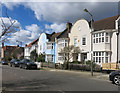
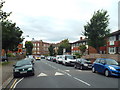
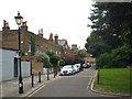
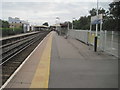
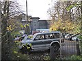
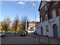
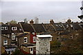
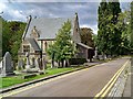
75 photos from this area
Area Information
Key information about the SW18 3NQ including its size, population, and administrative classification.
- Area Type
- Postcode
- Area Size
- 5104 m²
- Population
- 1315
- Population Density
- 5285 people/km²
House Prices in SW18 3NQ
17
Properties
£1,080,636
Average Sold Price
£347,500
Lowest Price
£2,075,000
Highest Price
Showing 17 properties
| Address | Type | Beds | Baths | Last Sale Price | Last Sale Date | |
|---|---|---|---|---|---|---|
| 41 Ellerton Road, London, SW18 3NQ | Terraced | 5 | - | £1,740,000 | Jul 2023 | |
| 45 Ellerton Road, London, SW18 3NQ | Terraced | 5 | 3 | £2,075,000 | Feb 2021 | |
| 53 Ellerton Road, London, SW18 3NQ | Terraced | 5 | 2 | £1,337,500 | Oct 2018 | |
| 63 Ellerton Road, London, SW18 3NQ | Terraced | 5 | - | £1,545,000 | Aug 2018 | |
| 55 Ellerton Road, London, SW18 3NQ | house | 4 | - | £1,025,000 | Jul 2012 | |
| 43 Ellerton Road, London, SW18 3NQ | house | 5 | - | £1,050,000 | Mar 2011 | |
| 39 Ellerton Road, London, SW18 3NQ | house | - | - | £665,000 | Jun 2009 | |
| 61 Ellerton Road, London, SW18 3NQ | Terraced | - | - | £970,000 | Aug 2007 | |
| 37 Ellerton Road, London, SW18 3NQ | Maisonette | 3 | 2 | £522,000 | Feb 2005 | |
| 57 Ellerton Road, London, SW18 3NQ | Terraced | - | - | £610,000 | Mar 2002 |
Page 1 of 2
Energy Efficiency in SW18 3NQ
Amenities
Schools
| Rank | School | Type | Entry gender | Ages |
|---|
Explore more schools in this area
Go to Schools tabDemographics
Household Size
Family (3-5 people)
most common
Accommodation Type
Houses
most common
Tenure
89
majority
Ethnic Group
White
most common
Religion
N/A
most common
Household Composition
N/A
most common
Age
47
median
Adults (30-64 years)
most common
Household Deprivation
N/A
with no deprivation
NS-SEC
62
in Lower managerial occupations
Explore more demographic insights in this area
Go to Demographics tabPlanning
Planning Constraints
- Flood RiskPremium
- Ramsar Wetland SitesPremium
- Area of Outstanding Natural BeautyPremium
- Protected Nature ReservePremium
- Protected WoodlandPremium