Area Overview for SW18 3DA
Photos of SW18 3DA
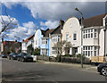
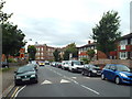
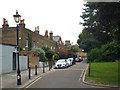
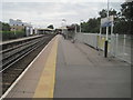
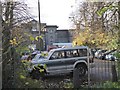
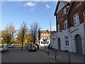
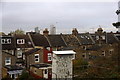
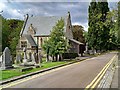
75 photos from this area
Area Information
Key information about the SW18 3DA including its size, population, and administrative classification.
- Area Type
- Postcode
- Area Size
- 1.9 hectares
- Population
- 1719
- Population Density
- 3854 people/km²
House Prices in SW18 3DA
88
Properties
£1,023,559
Average Sold Price
£147,000
Lowest Price
£2,200,000
Highest Price
Showing 88 properties
| Address | Type | Beds | Baths | Last Sale Price | Last Sale Date | |
|---|---|---|---|---|---|---|
| 95 Earlsfield Road, London, SW18 3DA | Terraced | 4 | 3 | £1,900,000 | Oct 2025 | |
| 83 Earlsfield Road, London, SW18 3DA | Detached | 5 | 2 | £1,705,000 | Aug 2024 | |
| 49 Earlsfield Road, London, SW18 3DA | Semi-detached | 5 | 3 | £2,200,000 | Jun 2023 | |
| 75A Earlsfield Road, London, SW18 3DA | house | - | - | £890,000 | Jun 2021 | |
| 73 Earlsfield Road, London, SW18 3DA | Flat | 3 | 2 | £1,501,000 | Mar 2021 | |
| 75B Earlsfield Road, London, SW18 3DA | Terraced | 6 | 3 | £850,000 | Oct 2016 | |
| 67 Earlsfield Road, London, SW18 3DA | Terraced | 6 | - | £1,325,000 | Dec 2013 | |
| 97 Earlsfield Road, London, SW18 3DA | Semi-detached | 5 | - | £1,215,000 | Jul 2012 | |
| Bramwell, 95A Earlsfield Road, London, SW18 3DA | Terraced | 6 | 3 | £1,000,000 | Jun 2011 | |
| 55 Earlsfield Road, London, SW18 3DA | Terraced | 5 | - | £1,200,000 | Apr 2011 |
Page 1 of 9
Energy Efficiency in SW18 3DA
Amenities
Schools
| Rank | School | Type | Entry gender | Ages |
|---|
Explore more schools in this area
Go to Schools tabDemographics
Household Size
Family (3-5 people)
most common
Accommodation Type
Flats
most common
Tenure
57
majority
Ethnic Group
White
most common
Religion
N/A
most common
Household Composition
N/A
most common
Age
47
median
Adults (30-64 years)
most common
Household Deprivation
N/A
with no deprivation
NS-SEC
57
in Lower managerial occupations
Explore more demographic insights in this area
Go to Demographics tabPlanning
Planning Constraints
- Flood RiskPremium
- Ramsar Wetland SitesPremium
- Area of Outstanding Natural BeautyPremium
- Protected Nature ReservePremium
- Protected WoodlandPremium