Area Overview for SW18 1GH
Photos of SW18 1GH
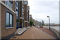
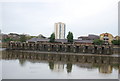
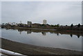

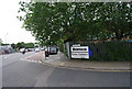
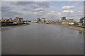
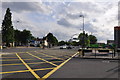
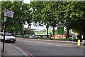
100 photos from this area
Area Information
Key information about the SW18 1GH including its size, population, and administrative classification.
- Area Type
- Postcode
- Area Size
- 2.6 hectares
- Population
- 1329
- Population Density
- 28458 people/km²
House Prices in SW18 1GH
34
Properties
£612,610
Average Sold Price
£400,000
Lowest Price
£1,400,000
Highest Price
Showing 34 properties
| Address | Type | Beds | Baths | Last Sale Price | Last Sale Date | |
|---|---|---|---|---|---|---|
| 23, Horizon House, Juniper Drive, London, SW18 1GH | Flat | - | - | £630,000 | Mar 2025 | |
| 27, Horizon House, Juniper Drive, London, SW18 1GH | Flat | 1 | 1 | £400,000 | Sep 2024 | |
| 8, Horizon House, Juniper Drive, London, SW18 1GH | Flat | - | - | £570,000 | Aug 2023 | |
| 21, Horizon House, Juniper Drive, London, SW18 1GH | Flat | - | - | £420,000 | Jul 2023 | |
| 3, Horizon House, Juniper Drive, London, SW18 1GH | Flat | 2 | 2 | £402,000 | Nov 2021 | |
| 6, Horizon House, Juniper Drive, London, SW18 1GH | Flat | - | - | £675,000 | Dec 2019 | |
| 20, Horizon House, Juniper Drive, London, SW18 1GH | Flat | - | - | £675,000 | Nov 2019 | |
| 16, Horizon House, Juniper Drive, London, SW18 1GH | Flat | 1 | 1 | £455,000 | Oct 2018 | |
| 14, Horizon House, Juniper Drive, London, SW18 1GH | Flat | 2 | 2 | £730,000 | Feb 2016 | |
| 31, Horizon House, Juniper Drive, London, SW18 1GH | Flat | - | - | £1,400,000 | Dec 2015 |
Page 1 of 4
Energy Efficiency in SW18 1GH
Amenities
Schools
| Rank | School | Type | Entry gender | Ages |
|---|
Explore more schools in this area
Go to Schools tabDemographics
Household Size
One person
most common
Accommodation Type
Flats
most common
Tenure
45
majority
Ethnic Group
White
most common
Religion
N/A
most common
Household Composition
N/A
most common
Age
47
median
Adults (30-64 years)
most common
Household Deprivation
N/A
with no deprivation
NS-SEC
66
in Lower managerial occupations
Explore more demographic insights in this area
Go to Demographics tabPlanning
Planning Constraints
- Flood RiskPremium
- Ramsar Wetland SitesPremium
- Area of Outstanding Natural BeautyPremium
- Protected Nature ReservePremium
- Protected WoodlandPremium