Area Overview for SW18 1DU
Photos of SW18 1DU

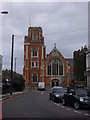
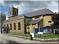
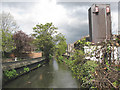
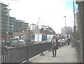
100 photos from this area
Area Information
Key information about the SW18 1DU including its size, population, and administrative classification.
- Area Type
- Postcode
- Area Size
- 3119 m²
- Population
- 1236
- Population Density
- 5024 people/km²
House Prices in SW18 1DU
17
Properties
£575,263
Average Sold Price
£119,950
Lowest Price
£885,000
Highest Price
Showing 17 properties
| Address | Type | Beds | Baths | Last Sale Price | Last Sale Date | |
|---|---|---|---|---|---|---|
| 8 Barchard Street, London, SW18 1DU | Terraced | 2 | 1 | £710,000 | Mar 2025 | |
| 14 Barchard Street, London, SW18 1DU | Terraced | 3 | 2 | £880,000 | Feb 2025 | |
| 18 Barchard Street, London, SW18 1DU | Terraced | 2 | 1 | £750,000 | Nov 2024 | |
| 36 Barchard Street, London, SW18 1DU | Maisonette | 2 | 1 | £500,000 | Aug 2024 | |
| 34 Barchard Street, London, SW18 1DU | Terraced | 3 | 2 | £700,000 | Jan 2024 | |
| 10 Barchard Street, London, SW18 1DU | Terraced | 2 | 2 | £885,000 | Jun 2022 | |
| 30 Barchard Street, London, SW18 1DU | Terraced | 3 | 2 | £708,000 | May 2021 | |
| 26 Barchard Street, London, SW18 1DU | Terraced | 3 | 2 | £810,000 | Mar 2021 | |
| 12 Barchard Street, London, SW18 1DU | Terraced | 2 | 1 | £740,000 | Feb 2021 | |
| 6 Barchard Street, London, SW18 1DU | Terraced | 3 | 2 | £350,000 | Aug 2011 |
Page 1 of 2
Energy Efficiency in SW18 1DU
Amenities
Schools
| Rank | School | Type | Entry gender | Ages |
|---|
Explore more schools in this area
Go to Schools tabDemographics
Household Size
Two person
most common
Accommodation Type
Flats
most common
Tenure
42
majority
Ethnic Group
White
most common
Religion
N/A
most common
Household Composition
N/A
most common
Age
47
median
Adults (30-64 years)
most common
Household Deprivation
N/A
with no deprivation
NS-SEC
72
in Lower managerial occupations
Explore more demographic insights in this area
Go to Demographics tabPlanning
Planning Constraints
- Flood RiskPremium
- Ramsar Wetland SitesPremium
- Area of Outstanding Natural BeautyPremium
- Protected Nature ReservePremium
- Protected WoodlandPremium