Area Overview for SW18 1BX
Photos of SW18 1BX

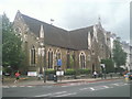
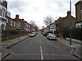

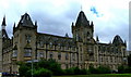
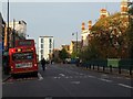

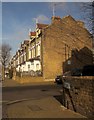
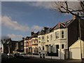
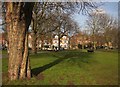
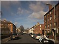
100 photos from this area
Area Information
Key information about the SW18 1BX including its size, population, and administrative classification.
- Area Type
- Postcode
- Area Size
- 6609 m²
- Population
- 1822
- Population Density
- 11123 people/km²
House Prices in SW18 1BX
40
Properties
£1,130,978
Average Sold Price
£192,000
Lowest Price
£1,500,000
Highest Price
Showing 40 properties
| Address | Type | Beds | Baths | Last Sale Price | Last Sale Date | |
|---|---|---|---|---|---|---|
| 24 Fullerton Road, London, SW18 1BX | Terraced | 4 | 2 | £1,500,000 | Apr 2025 | |
| 48 Fullerton Road, London, SW18 1BX | Terraced | 5 | 2 | £1,220,000 | Jul 2023 | |
| 46 Fullerton Road, London, SW18 1BX | Terraced | 3 | 1 | £1,200,000 | Mar 2022 | |
| 76 Fullerton Road, London, SW18 1BX | Terraced | 4 | 2 | £1,350,000 | Mar 2022 | |
| 66 Fullerton Road, London, SW18 1BX | house | 4 | 2 | £1,280,000 | Jan 2022 | |
| 32 Fullerton Road, London, SW18 1BX | Terraced | 2 | 2 | £1,335,000 | Sep 2020 | |
| 36 Fullerton Road, London, SW18 1BX | house | 4 | 2 | £1,210,000 | Sep 2020 | |
| 56 Fullerton Road, London, SW18 1BX | Terraced | 4 | 3 | £1,450,000 | Jul 2020 | |
| 44 Fullerton Road, London, SW18 1BX | Terraced | 4 | 2 | £1,250,000 | Dec 2019 | |
| 28 Fullerton Road, London, SW18 1BX | Terraced | 5 | 1 | £1,175,000 | May 2019 |
Page 1 of 4
Energy Efficiency in SW18 1BX
Amenities
Schools
| Rank | School | Type | Entry gender | Ages |
|---|
Explore more schools in this area
Go to Schools tabDemographics
Household Size
Two person
most common
Accommodation Type
Houses
most common
Tenure
51
majority
Ethnic Group
White
most common
Religion
N/A
most common
Household Composition
N/A
most common
Age
47
median
Adults (30-64 years)
most common
Household Deprivation
N/A
with no deprivation
NS-SEC
64
in Lower managerial occupations
Explore more demographic insights in this area
Go to Demographics tabPlanning
Planning Constraints
- Flood RiskPremium
- Ramsar Wetland SitesPremium
- Area of Outstanding Natural BeautyPremium
- Protected Nature ReservePremium
- Protected WoodlandPremium