Area Overview for SW18 1AP
Photos of SW18 1AP
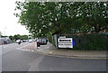
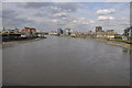
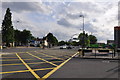
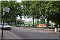
100 photos from this area
Area Information
Key information about the SW18 1AP including its size, population, and administrative classification.
- Area Type
- Postcode
- Area Size
- 2.0 hectares
- Population
- 1822
- Population Density
- 11123 people/km²
House Prices in SW18 1AP
42
Properties
£823,545
Average Sold Price
£222,480
Lowest Price
£1,322,500
Highest Price
Showing 42 properties
| Address | Type | Beds | Baths | Last Sale Price | Last Sale Date | |
|---|---|---|---|---|---|---|
| 46 Bramford Road, London, SW18 1AP | Terraced | 4 | 2 | £1,260,000 | Sep 2024 | |
| 38 Bramford Road, London, SW18 1AP | Terraced | 4 | 2 | £1,322,500 | Jun 2024 | |
| 48 Bramford Road, London, SW18 1AP | Terraced | 4 | 2 | £1,255,000 | Nov 2023 | |
| 42 Bramford Road, London, SW18 1AP | Detached | 3 | 2 | £1,140,000 | May 2023 | |
| 26 Bramford Road, London, SW18 1AP | Terraced | 3 | 2 | £1,215,000 | Nov 2022 | |
| 47 Bramford Road, London, SW18 1AP | Terraced | 4 | 2 | £1,300,000 | Apr 2022 | |
| 51 Bramford Road, London, SW18 1AP | Terraced | 3 | 2 | £955,000 | Sep 2021 | |
| 58 Bramford Road, London, SW18 1AP | Terraced | 3 | 2 | £1,235,000 | Jun 2021 | |
| 28 Bramford Road, London, SW18 1AP | house | - | - | £1,135,000 | Jun 2021 | |
| 36 Bramford Road, London, SW18 1AP | Terraced | 3 | 1 | £1,118,607 | Mar 2021 |
Page 1 of 5
Energy Efficiency in SW18 1AP
Amenities
Schools
| Rank | School | Type | Entry gender | Ages |
|---|
Explore more schools in this area
Go to Schools tabDemographics
Household Size
Two person
most common
Accommodation Type
Houses
most common
Tenure
51
majority
Ethnic Group
White
most common
Religion
N/A
most common
Household Composition
N/A
most common
Age
47
median
Adults (30-64 years)
most common
Household Deprivation
N/A
with no deprivation
NS-SEC
64
in Lower managerial occupations
Explore more demographic insights in this area
Go to Demographics tabPlanning
Planning Constraints
- Flood RiskPremium
- Ramsar Wetland SitesPremium
- Area of Outstanding Natural BeautyPremium
- Protected Nature ReservePremium
- Protected WoodlandPremium