Area Overview for SW17 9NE
Photos of SW17 9NE
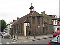
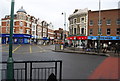
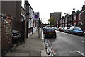
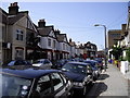
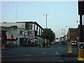
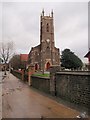
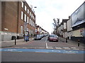
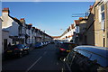
100 photos from this area
Area Information
Key information about the SW17 9NE including its size, population, and administrative classification.
- Area Type
- Postcode
- Area Size
- 7923 m²
- Population
- 1926
- Population Density
- 13807 people/km²
House Prices in SW17 9NE
56
Properties
£461,303
Average Sold Price
£27,500
Lowest Price
£4,780,000
Highest Price
Showing 56 properties
| Address | Type | Beds | Baths | Last Sale Price | Last Sale Date | |
|---|---|---|---|---|---|---|
| 66 Bickley Street, London, SW17 9NE | Maisonette | 2 | 1 | £530,000 | Feb 2025 | |
| 4 Bickley Street, London, SW17 9NE | Maisonette | 2 | 1 | £550,000 | Jan 2025 | |
| 26 Bickley Street, London, SW17 9NE | Maisonette | 2 | 1 | £440,000 | Oct 2024 | |
| 8 Bickley Street, London, SW17 9NE | Maisonette | 3 | 2 | £500,000 | Jul 2024 | |
| 68 Bickley Street, London, SW17 9NE | Maisonette | 3 | 1 | £710,000 | Apr 2024 | |
| 12 Bickley Street, London, SW17 9NE | Flat | 2 | 1 | £516,000 | Sep 2022 | |
| 22 Bickley Street, London, SW17 9NE | Flat | 3 | 3 | £757,000 | Apr 2022 | |
| 10 Bickley Street, London, SW17 9NE | Flat | - | - | £512,500 | Aug 2021 | |
| 106 Bickley Street, London, SW17 9NE | Maisonette | 2 | 1 | £527,000 | Jul 2020 | |
| 112 Bickley Street, London, SW17 9NE | Flat | - | - | £468,000 | Sep 2018 |
Page 1 of 6
Energy Efficiency in SW17 9NE
Amenities
Schools
| Rank | School | Type | Entry gender | Ages |
|---|
Explore more schools in this area
Go to Schools tabDemographics
Household Size
Family (3-5 people)
most common
Accommodation Type
Flats
most common
Tenure
32
majority
Ethnic Group
White
most common
Religion
N/A
most common
Household Composition
N/A
most common
Age
22
median
Adults (30-64 years)
most common
Household Deprivation
N/A
with no deprivation
NS-SEC
45
in Lower managerial occupations
Explore more demographic insights in this area
Go to Demographics tabPlanning
Planning Constraints
- Flood RiskPremium
- Ramsar Wetland SitesPremium
- Area of Outstanding Natural BeautyPremium
- Protected Nature ReservePremium
- Protected WoodlandPremium