Area Overview for SW17 9LR
Photos of SW17 9LR


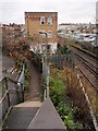
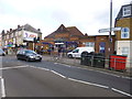
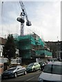
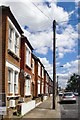


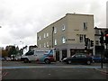
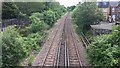
72 photos from this area
Area Information
Key information about the SW17 9LR including its size, population, and administrative classification.
- Area Type
- Postcode
- Area Size
- 9540 m²
- Population
- 1745
- Population Density
- 12840 people/km²
House Prices in SW17 9LR
49
Properties
£458,963
Average Sold Price
£41,000
Lowest Price
£1,015,000
Highest Price
Showing 49 properties
| Address | Type | Beds | Baths | Last Sale Price | Last Sale Date | |
|---|---|---|---|---|---|---|
| 49 Trevelyan Road, London, SW17 9LR | Terraced | 3 | 1 | £775,000 | Jul 2023 | |
| 63 Trevelyan Road, London, SW17 9LR | Detached | 4 | 3 | £1,015,000 | Feb 2022 | |
| 81 Trevelyan Road, London, SW17 9LR | Terraced | 3 | 1 | £610,000 | Mar 2020 | |
| 31 Trevelyan Road, London, SW17 9LR | Semi-detached | 3 | 1 | £700,000 | Jan 2020 | |
| 77 Trevelyan Road, London, SW17 9LR | Terraced | 3 | 1 | £835,000 | Aug 2019 | |
| 57 Trevelyan Road, London, SW17 9LR | Terraced | 4 | 2 | £920,000 | Jan 2019 | |
| 71 Trevelyan Road, London, SW17 9LR | Terraced | 3 | 1 | £730,000 | May 2018 | |
| 47 Trevelyan Road, London, SW17 9LR | Terraced | 3 | 2 | £755,000 | Nov 2017 | |
| 39 Trevelyan Road, London, SW17 9LR | Flat | 2 | 1 | £41,000 | Dec 2016 | |
| 35 Trevelyan Road, London, SW17 9LR | Semi-detached | 4 | - | £575,000 | Sep 2013 |
Page 1 of 5
Energy Efficiency in SW17 9LR
Amenities
Schools
| Rank | School | Type | Entry gender | Ages |
|---|
Explore more schools in this area
Go to Schools tabDemographics
Household Size
Two person
most common
Accommodation Type
Flats
most common
Tenure
50
majority
Ethnic Group
White
most common
Religion
N/A
most common
Household Composition
N/A
most common
Age
47
median
Adults (30-64 years)
most common
Household Deprivation
N/A
with no deprivation
NS-SEC
49
in Lower managerial occupations
Explore more demographic insights in this area
Go to Demographics tabPlanning
Planning Constraints
- Flood RiskPremium
- Ramsar Wetland SitesPremium
- Area of Outstanding Natural BeautyPremium
- Protected Nature ReservePremium
- Protected WoodlandPremium