Area Overview for SW17 9HL
Photos of SW17 9HL


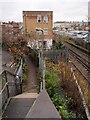
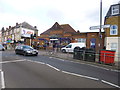
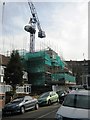
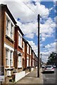


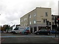
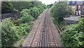
72 photos from this area
Area Information
Key information about the SW17 9HL including its size, population, and administrative classification.
- Area Type
- Postcode
- Area Size
- 5578 m²
- Population
- 2103
- Population Density
- 17167 people/km²
House Prices in SW17 9HL
59
Properties
£384,192
Average Sold Price
£36,500
Lowest Price
£700,000
Highest Price
Showing 59 properties
| Address | Type | Beds | Baths | Last Sale Price | Last Sale Date | |
|---|---|---|---|---|---|---|
| 61 Glasford Street, London, SW17 9HL | Maisonette | 2 | 1 | £535,000 | Mar 2025 | |
| 33 Glasford Street, London, SW17 9HL | Maisonette | 2 | 1 | £516,000 | Sep 2024 | |
| 61A Glasford Street, London, SW17 9HL | Maisonette | 2 | 1 | £448,000 | Dec 2023 | |
| 25 Glasford Street, London, SW17 9HL | Maisonette | - | - | £447,000 | Oct 2023 | |
| 9A Glasford Street, London, SW17 9HL | Maisonette | 3 | 1 | £540,000 | Sep 2023 | |
| 31 Glasford Street, London, SW17 9HL | Flat | 2 | 1 | £470,000 | Mar 2023 | |
| 55A Glasford Street, London, SW17 9HL | Flat | 2 | 1 | £506,000 | Mar 2023 | |
| 17 Glasford Street, London, SW17 9HL | Flat | 2 | 1 | £499,000 | Jul 2022 | |
| 27 Glasford Street, London, SW17 9HL | Maisonette | 2 | 1 | £457,500 | Jan 2022 | |
| 11 Glasford Street, London, SW17 9HL | Flat | 2 | 1 | £485,000 | Jun 2021 |
Page 1 of 6
Energy Efficiency in SW17 9HL
Amenities
Schools
| Rank | School | Type | Entry gender | Ages |
|---|
Explore more schools in this area
Go to Schools tabDemographics
Household Size
Family (3-5 people)
most common
Accommodation Type
Flats
most common
Tenure
45
majority
Ethnic Group
White
most common
Religion
N/A
most common
Household Composition
N/A
most common
Age
47
median
Adults (30-64 years)
most common
Household Deprivation
N/A
with no deprivation
NS-SEC
54
in Lower managerial occupations
Explore more demographic insights in this area
Go to Demographics tabPlanning
Planning Constraints
- Flood RiskPremium
- Ramsar Wetland SitesPremium
- Area of Outstanding Natural BeautyPremium
- Protected Nature ReservePremium
- Protected WoodlandPremium