Area Overview for SW17 9ES
Photos of SW17 9ES
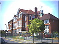
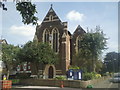
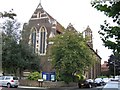
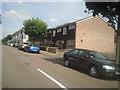
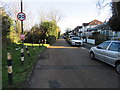
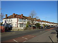
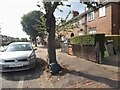
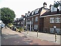
63 photos from this area
Area Information
Key information about the SW17 9ES including its size, population, and administrative classification.
- Area Type
- Postcode
- Area Size
- 1.3 hectares
- Population
- 1522
- Population Density
- 12079 people/km²
House Prices in SW17 9ES
67
Properties
£462,282
Average Sold Price
£70,000
Lowest Price
£900,000
Highest Price
Showing 67 properties
| Address | Type | Beds | Baths | Last Sale Price | Last Sale Date | |
|---|---|---|---|---|---|---|
| 156 Links Road, Tooting, London, SW17 9ES | Terraced | 3 | 1 | £700,000 | Mar 2025 | |
| 202 Links Road, Tooting, London, SW17 9ES | Terraced | 4 | 1 | £605,000 | Mar 2025 | |
| 210 Links Road, Tooting, London, SW17 9ES | Terraced | 3 | 1 | £532,250 | Mar 2025 | |
| 176 Links Road, Tooting, London, SW17 9ES | Terraced | 3 | 1 | £900,000 | Aug 2024 | |
| 126 Links Road, Tooting, London, SW17 9ES | house | 3 | - | £775,000 | Oct 2023 | |
| 162 Links Road, Tooting, London, SW17 9ES | Terraced | 4 | 3 | £860,000 | Jun 2022 | |
| 112 Links Road, Tooting, London, SW17 9ES | house | - | - | £550,000 | Apr 2022 | |
| 142 Links Road, Tooting, London, SW17 9ES | house | - | - | £649,522 | Jul 2021 | |
| 198 Links Road, Tooting, London, SW17 9ES | house | - | - | £723,000 | Feb 2021 | |
| 204 Links Road, Tooting, London, SW17 9ES | house | 4 | - | £800,000 | Sep 2020 |
Page 1 of 7
Energy Efficiency in SW17 9ES
Amenities
Schools
| Rank | School | Type | Entry gender | Ages |
|---|
Explore more schools in this area
Go to Schools tabDemographics
Household Size
Family (3-5 people)
most common
Accommodation Type
Houses
most common
Tenure
64
majority
Ethnic Group
White
most common
Religion
N/A
most common
Household Composition
N/A
most common
Age
47
median
Adults (30-64 years)
most common
Household Deprivation
N/A
with no deprivation
NS-SEC
36
in Lower managerial occupations
Explore more demographic insights in this area
Go to Demographics tabPlanning
Planning Constraints
- Flood RiskPremium
- Ramsar Wetland SitesPremium
- Area of Outstanding Natural BeautyPremium
- Protected Nature ReservePremium
- Protected WoodlandPremium