Area Overview for SW17 8TG
Photos of SW17 8TG

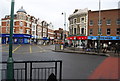
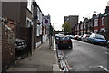
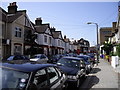
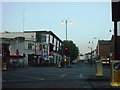
100 photos from this area
Area Information
Key information about the SW17 8TG including its size, population, and administrative classification.
- Area Type
- Postcode
- Area Size
- 7624 m²
- Population
- 1659
- Population Density
- 16524 people/km²
House Prices in SW17 8TG
40
Properties
£502,611
Average Sold Price
£99,995
Lowest Price
£1,400,000
Highest Price
Showing 40 properties
| Address | Type | Beds | Baths | Last Sale Price | Last Sale Date | |
|---|---|---|---|---|---|---|
| 37 Vant Road, London, SW17 8TG | Flat | - | - | £625,000 | Jun 2023 | |
| 69 Vant Road, London, SW17 8TG | Detached | 4 | 2 | £545,000 | Oct 2022 | |
| 39 Vant Road, London, SW17 8TG | Flat | 1 | 1 | £470,000 | Sep 2022 | |
| 29 Vant Road, London, SW17 8TG | house | - | - | £1,200,000 | Sep 2022 | |
| 43 Vant Road, London, SW17 8TG | house | - | - | £1,400,000 | Aug 2022 | |
| 33 Vant Road, London, SW17 8TG | Terraced | 4 | - | £1,000,000 | Jul 2019 | |
| 49 Vant Road, London, SW17 8TG | Terraced | 4 | 2 | £750,000 | Aug 2018 | |
| 31 Vant Road, London, SW17 8TG | Terraced | 3 | - | £675,000 | Nov 2014 | |
| 65 Vant Road, London, SW17 8TG | Terraced | 5 | - | £630,000 | Oct 2013 | |
| 57 Vant Road, London, SW17 8TG | Flat | 2 | 1 | £170,000 | Jul 2010 |
Page 1 of 4
Energy Efficiency in SW17 8TG
Amenities
Schools
| Rank | School | Type | Entry gender | Ages |
|---|
Explore more schools in this area
Go to Schools tabDemographics
Household Size
Family (3-5 people)
most common
Accommodation Type
Houses
most common
Tenure
51
majority
Ethnic Group
White
most common
Religion
N/A
most common
Household Composition
N/A
most common
Age
47
median
Adults (30-64 years)
most common
Household Deprivation
N/A
with no deprivation
NS-SEC
49
in Lower managerial occupations
Explore more demographic insights in this area
Go to Demographics tabPlanning
Planning Constraints
- Flood RiskPremium
- Ramsar Wetland SitesPremium
- Area of Outstanding Natural BeautyPremium
- Protected Nature ReservePremium
- Protected WoodlandPremium