Area Overview for SW17 8SD
Photos of SW17 8SD
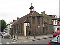
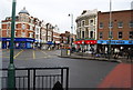
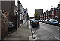
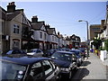
100 photos from this area
Area Information
Key information about the SW17 8SD including its size, population, and administrative classification.
- Area Type
- Postcode
- Area Size
- 3883 m²
- Population
- 1547
- Population Density
- 12608 people/km²
House Prices in SW17 8SD
22
Properties
£441,708
Average Sold Price
£79,000
Lowest Price
£884,000
Highest Price
Showing 22 properties
| Address | Type | Beds | Baths | Last Sale Price | Last Sale Date | |
|---|---|---|---|---|---|---|
| 26 Lynwood Road, London, SW17 8SD | Terraced | 4 | - | £815,000 | Nov 2020 | |
| 18 Lynwood Road, London, SW17 8SD | Terraced | 5 | 1 | £725,000 | Oct 2019 | |
| 44 Lynwood Road, London, SW17 8SD | Terraced | 4 | 2 | £850,000 | Dec 2017 | |
| 60 Lynwood Road, London, SW17 8SD | house | 4 | 1 | £884,000 | Apr 2017 | |
| 54 Lynwood Road, London, SW17 8SD | house | - | - | £632,500 | Jun 2015 | |
| 34 Lynwood Road, London, SW17 8SD | Flat | - | - | £415,000 | May 2012 | |
| 46 Lynwood Road, London, SW17 8SD | house | - | - | £265,000 | Jan 2003 | |
| 24 Lynwood Road, London, SW17 8SD | Detached | 4 | 1 | £244,000 | Oct 2002 | |
| 42 Lynwood Road, London, SW17 8SD | house | - | - | £145,000 | Apr 1999 | |
| 20 Lynwood Road, London, SW17 8SD | house | - | - | £148,000 | Jul 1998 |
Page 1 of 3
Energy Efficiency in SW17 8SD
Amenities
Schools
| Rank | School | Type | Entry gender | Ages |
|---|
Explore more schools in this area
Go to Schools tabDemographics
Household Size
Family (3-5 people)
most common
Accommodation Type
Houses
most common
Tenure
57
majority
Ethnic Group
White
most common
Religion
N/A
most common
Household Composition
N/A
most common
Age
47
median
Adults (30-64 years)
most common
Household Deprivation
N/A
with no deprivation
NS-SEC
53
in Lower managerial occupations
Explore more demographic insights in this area
Go to Demographics tabPlanning
Planning Constraints
- Flood RiskPremium
- Ramsar Wetland SitesPremium
- Area of Outstanding Natural BeautyPremium
- Protected Nature ReservePremium
- Protected WoodlandPremium