Area Overview for SW17 8PN
Photos of SW17 8PN
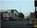
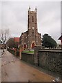
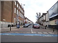
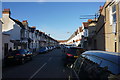
100 photos from this area
Area Information
Key information about the SW17 8PN including its size, population, and administrative classification.
- Area Type
- Postcode
- Area Size
- 1.0 hectares
- Population
- 1926
- Population Density
- 13807 people/km²
House Prices in SW17 8PN
42
Properties
£355,193
Average Sold Price
£58,950
Lowest Price
£870,000
Highest Price
Showing 42 properties
| Address | Type | Beds | Baths | Last Sale Price | Last Sale Date | |
|---|---|---|---|---|---|---|
| 44 Longmead Road, London, SW17 8PN | Terraced | 3 | 1 | £745,000 | Jul 2024 | |
| 13 Longmead Road, London, SW17 8PN | house | 4 | 2 | £870,000 | Jul 2022 | |
| 32 Longmead Road, London, SW17 8PN | Terraced | 4 | 1 | £840,000 | Aug 2017 | |
| 42 Longmead Road, London, SW17 8PN | Terraced | 4 | 2 | £715,000 | Oct 2016 | |
| 17 Longmead Road, London, SW17 8PN | Terraced | 5 | 2 | £600,000 | Oct 2016 | |
| 16 Longmead Road, London, SW17 8PN | Terraced | 6 | 3 | £590,000 | Feb 2016 | |
| 3 Longmead Road, London, SW17 8PN | Flat | 2 | - | £250,000 | Apr 2013 | |
| 21 Longmead Road, London, SW17 8PN | Terraced | 3 | 2 | £325,000 | Nov 2011 | |
| 36 Longmead Road, London, SW17 8PN | house | 3 | 1 | £325,000 | Sep 2009 | |
| 12 Longmead Road, London, SW17 8PN | Terraced | 3 | - | £285,000 | Jul 2009 |
Page 1 of 5
Energy Efficiency in SW17 8PN
Amenities
Schools
| Rank | School | Type | Entry gender | Ages |
|---|
Explore more schools in this area
Go to Schools tabDemographics
Household Size
Family (3-5 people)
most common
Accommodation Type
Flats
most common
Tenure
32
majority
Ethnic Group
White
most common
Religion
N/A
most common
Household Composition
N/A
most common
Age
22
median
Adults (30-64 years)
most common
Household Deprivation
N/A
with no deprivation
NS-SEC
45
in Lower managerial occupations
Explore more demographic insights in this area
Go to Demographics tabPlanning
Planning Constraints
- Flood RiskPremium
- Ramsar Wetland SitesPremium
- Area of Outstanding Natural BeautyPremium
- Protected Nature ReservePremium
- Protected WoodlandPremium