Area Overview for SW17 8NS
Photos of SW17 8NS

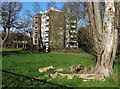

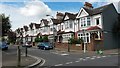
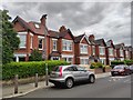
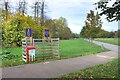

70 photos from this area
Area Information
Key information about the SW17 8NS including its size, population, and administrative classification.
- Area Type
- Postcode
- Area Size
- 1458 m²
- Population
- 1448
- Population Density
- 16549 people/km²
House Prices in SW17 8NS
12
Properties
£380,714
Average Sold Price
£60,000
Lowest Price
£795,000
Highest Price
Showing 12 properties
| Address | Type | Beds | Baths | Last Sale Price | Last Sale Date | |
|---|---|---|---|---|---|---|
| 69 Okeburn Road, London, SW17 8NS | house | - | - | £650,000 | Jul 2024 | |
| 61 Okeburn Road, London, SW17 8NS | house | 3 | - | £695,000 | Jun 2021 | |
| 59 Okeburn Road, London, SW17 8NS | Terraced | 1 | 1 | £795,000 | Jan 2015 | |
| 63 Okeburn Road, London, SW17 8NS | Terraced | - | - | £270,000 | Oct 2003 | |
| 71 Okeburn Road, London, SW17 8NS | Terraced | - | - | £90,000 | Oct 2001 | |
| 67 Okeburn Road, London, SW17 8NS | house | - | - | £60,000 | Oct 1997 | |
| 73 Okeburn Road, London, SW17 8NS | Detached | 3 | 2 | £105,000 | Aug 1997 | |
| Flat A, 57 Okeburn Road, London, SW17 8NS | Maisonette | 2 | 1 | - | - | |
| Ground Floor Flat, 57 Okeburn Road, London, SW17 8NS | Flat | 4 | - | - | - | |
| 65 Okeburn Road, London, SW17 8NS | house | - | - | - | - |
Page 1 of 2
Energy Efficiency in SW17 8NS
Amenities
Schools
| Rank | School | Type | Entry gender | Ages |
|---|
Explore more schools in this area
Go to Schools tabDemographics
Household Size
Two person
most common
Accommodation Type
Houses
most common
Tenure
40
majority
Ethnic Group
White
most common
Religion
N/A
most common
Household Composition
N/A
most common
Age
47
median
Adults (30-64 years)
most common
Household Deprivation
N/A
with no deprivation
NS-SEC
47
in Lower managerial occupations
Explore more demographic insights in this area
Go to Demographics tabPlanning
Planning Constraints
- Flood RiskPremium
- Ramsar Wetland SitesPremium
- Area of Outstanding Natural BeautyPremium
- Protected Nature ReservePremium
- Protected WoodlandPremium