Area Overview for SW17 8NF
Photos of SW17 8NF
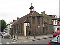
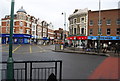
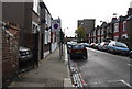
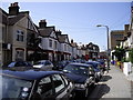
100 photos from this area
Area Information
Key information about the SW17 8NF including its size, population, and administrative classification.
- Area Type
- Postcode
- Area Size
- 6960 m²
- Population
- 1763
- Population Density
- 20382 people/km²
House Prices in SW17 8NF
43
Properties
£441,795
Average Sold Price
£132,000
Lowest Price
£720,000
Highest Price
Showing 43 properties
| Address | Type | Beds | Baths | Last Sale Price | Last Sale Date | |
|---|---|---|---|---|---|---|
| 66 Lessingham Avenue, London, SW17 8NF | Terraced | 2 | 1 | £700,000 | Aug 2023 | |
| 72 Lessingham Avenue, London, SW17 8NF | Terraced | 2 | 1 | £645,000 | Jun 2022 | |
| 108 Lessingham Avenue, London, SW17 8NF | house | 3 | 1 | £660,000 | Apr 2022 | |
| 112 Lessingham Avenue, London, SW17 8NF | Terraced | 3 | 2 | £587,500 | Mar 2022 | |
| 44 Lessingham Avenue, London, SW17 8NF | house | - | - | £550,000 | Apr 2021 | |
| 84 Lessingham Avenue, London, SW17 8NF | Terraced | 3 | 1 | £720,000 | Aug 2018 | |
| 116 Lessingham Avenue, London, SW17 8NF | Terraced | 3 | 1 | £665,000 | Dec 2016 | |
| 42 Lessingham Avenue, London, SW17 8NF | Terraced | - | - | £372,000 | Nov 2007 | |
| 122 Lessingham Avenue, London, SW17 8NF | house | - | - | £265,000 | Sep 2005 | |
| 90 Lessingham Avenue, London, SW17 8NF | house | - | - | £232,000 | May 2004 |
Page 1 of 5
Energy Efficiency in SW17 8NF
Amenities
Schools
| Rank | School | Type | Entry gender | Ages |
|---|
Explore more schools in this area
Go to Schools tabDemographics
Household Size
Family (3-5 people)
most common
Accommodation Type
Houses
most common
Tenure
47
majority
Ethnic Group
White
most common
Religion
N/A
most common
Household Composition
N/A
most common
Age
47
median
Adults (30-64 years)
most common
Household Deprivation
N/A
with no deprivation
NS-SEC
45
in Lower managerial occupations
Explore more demographic insights in this area
Go to Demographics tabPlanning
Planning Constraints
- Flood RiskPremium
- Ramsar Wetland SitesPremium
- Area of Outstanding Natural BeautyPremium
- Protected Nature ReservePremium
- Protected WoodlandPremium