Area Overview for SW17 7RN
Photos of SW17 7RN

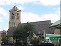
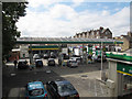
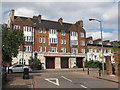
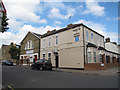

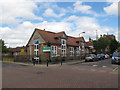
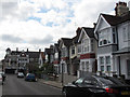
100 photos from this area
Area Information
Key information about the SW17 7RN including its size, population, and administrative classification.
- Area Type
- Postcode
- Area Size
- 1.3 hectares
- Population
- 1425
- Population Density
- 12287 people/km²
House Prices in SW17 7RN
43
Properties
£1,208,875
Average Sold Price
£200,000
Lowest Price
£3,400,000
Highest Price
Showing 43 properties
| Address | Type | Beds | Baths | Last Sale Price | Last Sale Date | |
|---|---|---|---|---|---|---|
| 17 St Jamess Drive, London, SW17 7RN | Terraced | 5 | 2 | £1,492,500 | Mar 2023 | |
| 27 St Jamess Drive, London, SW17 7RN | Detached | 5 | 4 | £2,950,000 | Sep 2021 | |
| 45 St Jamess Drive, London, SW17 7RN | Terraced | 4 | 2 | £1,600,000 | Aug 2020 | |
| 41 St Jamess Drive, London, SW17 7RN | Maisonette | 4 | 1 | £2,850,000 | Jun 2020 | |
| 11 St Jamess Drive, London, SW17 7RN | Maisonette | 4 | 1 | £2,685,000 | Aug 2016 | |
| 29 St Jamess Drive, London, SW17 7RN | Semi-detached | - | - | £1,300,000 | Nov 2010 | |
| 25A St Jamess Drive, London, SW17 7RN | house | - | - | £470,000 | Feb 2007 | |
| 21 St Jamess Drive, London, SW17 7RN | Terraced | - | - | £1,450,000 | Dec 2006 | |
| 31 St Jamess Drive, London, SW17 7RN | Semi-detached | - | - | £1,085,000 | Sep 2006 | |
| 39 St Jamess Drive, London, SW17 7RN | Terraced | - | - | £3,400,000 | Apr 2006 |
Page 1 of 5
Energy Efficiency in SW17 7RN
Amenities
Schools
| Rank | School | Type | Entry gender | Ages |
|---|
Explore more schools in this area
Go to Schools tabDemographics
Household Size
Family (3-5 people)
most common
Accommodation Type
Houses
most common
Tenure
47
majority
Ethnic Group
White
most common
Religion
N/A
most common
Household Composition
N/A
most common
Age
47
median
Adults (30-64 years)
most common
Household Deprivation
N/A
with no deprivation
NS-SEC
52
in Lower managerial occupations
Explore more demographic insights in this area
Go to Demographics tabPlanning
Planning Constraints
- Flood RiskPremium
- Ramsar Wetland SitesPremium
- Area of Outstanding Natural BeautyPremium
- Protected Nature ReservePremium
- Protected WoodlandPremium