Area Overview for SW17 7ED
Photos of SW17 7ED
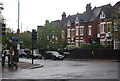
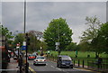
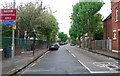
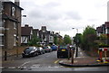
100 photos from this area
Area Information
Key information about the SW17 7ED including its size, population, and administrative classification.
- Area Type
- Postcode
- Area Size
- 1.2 hectares
- Population
- 1743
- Population Density
- 8316 people/km²
House Prices in SW17 7ED
58
Properties
£1,342,871
Average Sold Price
£295,000
Lowest Price
£3,150,000
Highest Price
Showing 58 properties
| Address | Type | Beds | Baths | Last Sale Price | Last Sale Date | |
|---|---|---|---|---|---|---|
| 47 Althorp Road, London, SW17 7ED | Terraced | 4 | 2 | £1,650,000 | Jan 2025 | |
| 5 Althorp Road, London, SW17 7ED | Semi-detached | 5 | 3 | £2,150,000 | Mar 2024 | |
| 19 Althorp Road, London, SW17 7ED | Terraced | 5 | - | £1,970,000 | Dec 2023 | |
| 38 Althorp Road, London, SW17 7ED | Terraced | 4 | - | £1,760,000 | Oct 2023 | |
| 16 Althorp Road, London, SW17 7ED | house | - | - | £1,801,500 | Jun 2023 | |
| 45 Althorp Road, London, SW17 7ED | Terraced | 5 | 3 | £1,575,000 | Aug 2022 | |
| 44 Althorp Road, London, SW17 7ED | Terraced | 3 | 3 | £1,590,000 | Apr 2021 | |
| 48 Althorp Road, London, SW17 7ED | house | - | - | £1,570,000 | Dec 2020 | |
| 30 Althorp Road, London, SW17 7ED | Terraced | 6 | - | £2,775,000 | Sep 2020 | |
| 33 Althorp Road, London, SW17 7ED | Terraced | 3 | 1 | £1,269,000 | Aug 2019 |
Page 1 of 6
Energy Efficiency in SW17 7ED
Amenities
Schools
| Rank | School | Type | Entry gender | Ages |
|---|
Explore more schools in this area
Go to Schools tabDemographics
Household Size
Two person
most common
Accommodation Type
Flats
most common
Tenure
58
majority
Ethnic Group
White
most common
Religion
N/A
most common
Household Composition
N/A
most common
Age
47
median
Adults (30-64 years)
most common
Household Deprivation
N/A
with no deprivation
NS-SEC
66
in Lower managerial occupations
Explore more demographic insights in this area
Go to Demographics tabPlanning
Planning Constraints
- Flood RiskPremium
- Ramsar Wetland SitesPremium
- Area of Outstanding Natural BeautyPremium
- Protected Nature ReservePremium
- Protected WoodlandPremium