Area Overview for SW17 0SG
Photos of SW17 0SG


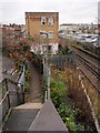
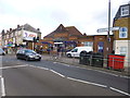
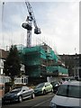
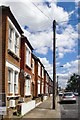


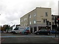
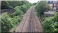
72 photos from this area
Area Information
Key information about the SW17 0SG including its size, population, and administrative classification.
- Area Type
- Postcode
- Area Size
- 2350 m²
- Population
- 1909
- Population Density
- 4424 people/km²
House Prices in SW17 0SG
34
Properties
£207,333
Average Sold Price
£162,000
Lowest Price
£280,000
Highest Price
Showing 34 properties
| Address | Type | Beds | Baths | Last Sale Price | Last Sale Date | |
|---|---|---|---|---|---|---|
| 216A Tooting High Street, London, SW17 0SG | Flat | 1 | 1 | £280,000 | Dec 2021 | |
| 208A Tooting High Street, London, SW17 0SG | Flat | 2 | 1 | £180,000 | Aug 2010 | |
| 210A Tooting High Street, London, SW17 0SG | Flat | - | - | £162,000 | Aug 2001 | |
| Flat C, 204 Tooting High Street, London, SW17 0SG | Detached | 3 | 1 | - | - | |
| 210B Tooting High Street, London, SW17 0SG | Flat | 2 | 1 | - | - | |
| Flat Rear Of, 224 Tooting High Street, London, SW17 0SG | Flat | - | - | - | - | |
| 208 Tooting High Street, London, SW17 0SG | Office | - | - | - | - | |
| Flat Second Floor B, 206 Tooting High Street, London, SW17 0SG | Flat | - | - | - | - | |
| Flat Second Floor 2, 220A Tooting High Street, London, SW17 0SG | Flat | - | - | - | - | |
| Studio Flat Rear, 222 Tooting High Street, London, SW17 0SG | Flat | - | - | - | - |
Page 1 of 4
Energy Efficiency in SW17 0SG
Amenities
Schools
| Rank | School | Type | Entry gender | Ages |
|---|
Explore more schools in this area
Go to Schools tabDemographics
Household Size
Family (3-5 people)
most common
Accommodation Type
Flats
most common
Tenure
28
majority
Ethnic Group
White
most common
Religion
N/A
most common
Household Composition
N/A
most common
Age
22
median
Young Adults (15-29 years)
most common
Household Deprivation
N/A
with no deprivation
NS-SEC
40
in Lower managerial occupations
Explore more demographic insights in this area
Go to Demographics tabPlanning
Planning Constraints
- Flood RiskPremium
- Ramsar Wetland SitesPremium
- Area of Outstanding Natural BeautyPremium
- Protected Nature ReservePremium
- Protected WoodlandPremium